MyTopo
McGregor Peak Montana US Topo Map
Couldn't load pickup availability
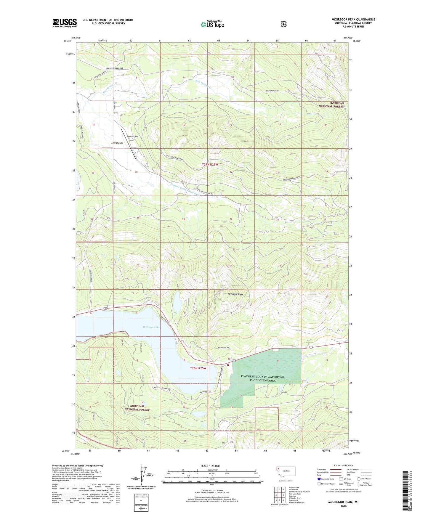
2020 topographic map quadrangle McGregor Peak in the state of Montana. Scale: 1:24000. Based on the newly updated USGS 7.5' US Topo map series, this map is in the following counties: Flathead. The map contains contour data, water features, and other items you are used to seeing on USGS maps, but also has updated roads and other features. This is the next generation of topographic maps. Printed on high-quality waterproof paper with UV fade-resistant inks.
Quads adjacent to this one:
West: Meadow Peak
Northwest: Lynch Lake
North: Dahl Lake
Northeast: Pleasant Valley Mountain
East: Marion
Southeast: Hubbart Reservoir
South: Murr Peak
Southwest: Shroder Creek
Contains the following named places: Averill Dam, Bear Springs Creek, Boisvert Camp, Carson Field, Castle Rock Trail, Little McGregor Lake, Lost Prairie, Marion Rural Fire District - Mc Gregor Lake Station, McGregor Lake, McGregor Peak, Paradise Lodge, Thompson Chain of Lakes Fishing Access Site, ZIP Code: 59925