MyTopo
Piquett Creek Montana US Topo Map
Couldn't load pickup availability
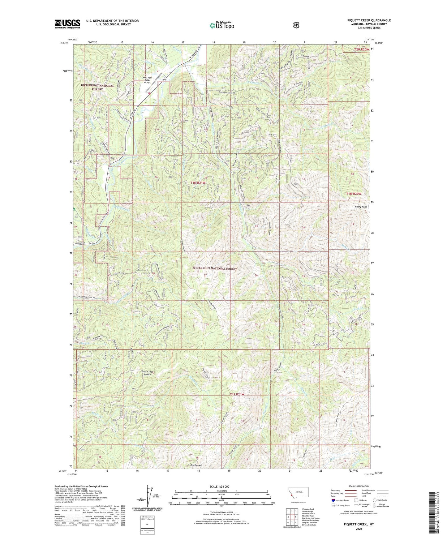
2020 topographic map quadrangle Piquett Creek in the state of Montana. Scale: 1:24000. Based on the newly updated USGS 7.5' US Topo map series, this map is in the following counties: Ravalli. The map contains contour data, water features, and other items you are used to seeing on USGS maps, but also has updated roads and other features. This is the next generation of topographic maps. Printed on high-quality waterproof paper with UV fade-resistant inks.
Quads adjacent to this one:
West: Boulder Peak
Northwest: Trapper Peak
North: Burnt Ridge
Northeast: Robbins Gulch
East: Medicine Hot Springs
Southeast: Overwhich Falls
South: Piquett Mountain
Southwest: Painted Rocks Lake
Contains the following named places: Applebury Creek, Baker Creek, Billings Memorial Campground, Boulder Creek, Boulder Creek Campground, Britts Creek, Buck Creek Saddle, Castle Creek, Christisen Creek, East Piquett Creek, House Creek, Lavene Creek, Line Creek, Lloyd Creek, North Creek, Notch Creek, Pine Creek, Piquett Creek, Rocky Knob, Rs West Fork Lodge, Steep Creek, Troy Creek, Violet Creek, West Creek, West Fork Lodge Airport, West Fork Volunteer Fire Department and Quick Response Unit