
MyTopo
Arnold Nebraska US Topo Map
Couldn't load pickup availability
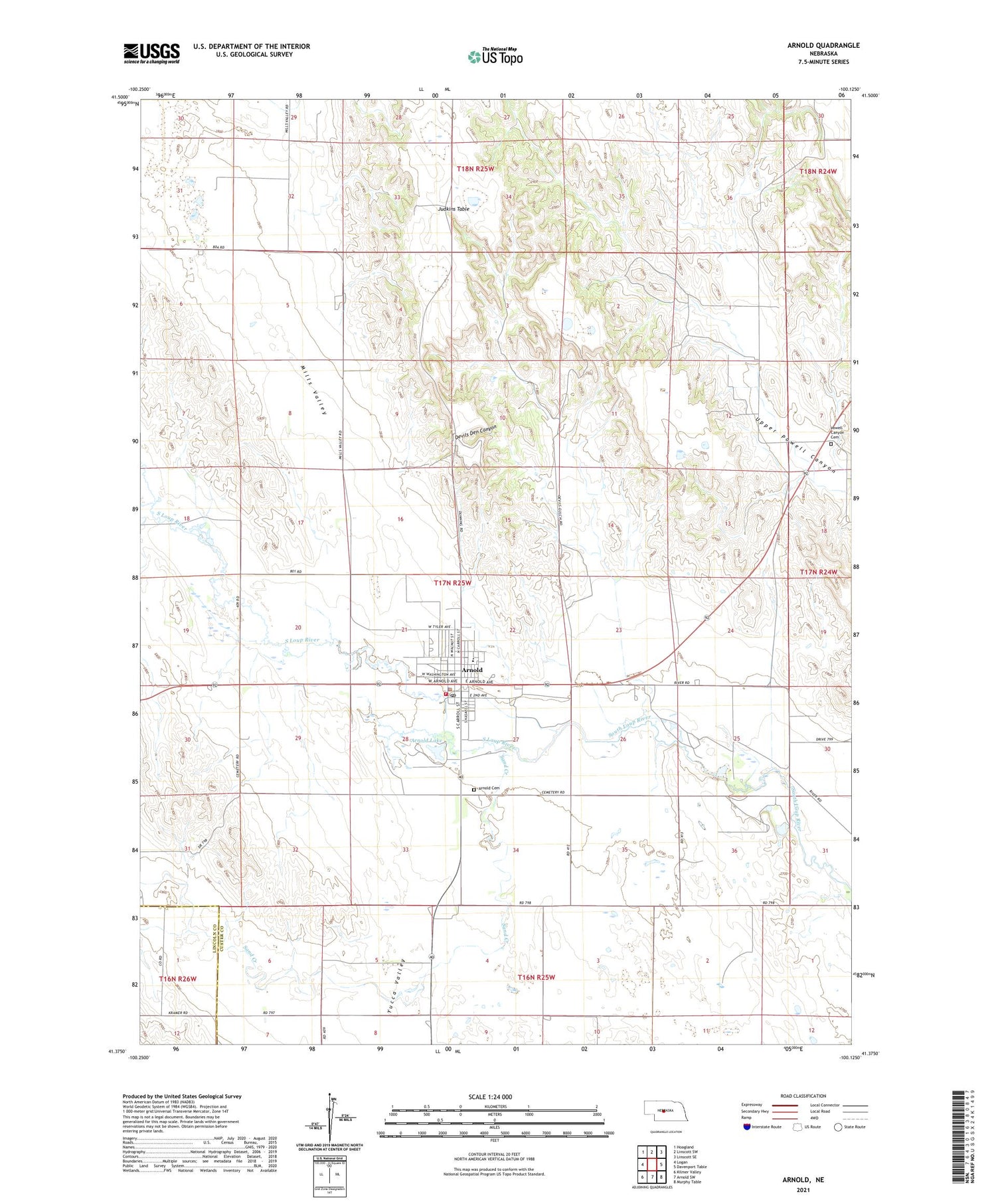
2021 topographic map quadrangle Arnold in the state of Nebraska. Scale: 1:24000. Based on the newly updated USGS 7.5' US Topo map series, this map is in the following counties: Custer, Lincoln. The map contains contour data, water features, and other items you are used to seeing on USGS maps, but also has updated roads and other features. This is the next generation of topographic maps. Printed on high-quality waterproof paper with UV fade-resistant inks.
Quads adjacent to this one:
West: Logan
Northwest: Hoagland
North: Linscott SW
Northeast: Linscott SE
East: Davenport Table
Southeast: Murphy Table
South: Arnold SW
Southwest: Kilmer Valley
Contains the following named places: Arnold, Arnold 9 Hole Golf Course, Arnold Cemetery, Arnold Child Care Center, Arnold City Park, Arnold Dental Clinic, Arnold Lake, Arnold Lake State Recreation Area, Arnold Medical Clinic, Arnold Mini Park, Arnold Motel and Camp Site, Arnold Police Department, Arnold Post Office, Arnold Public Library, Arnold Public Schools, Arnold Volunteer Fire Department, Baptist Church, Church of the Nazarene, Devils Den Canyon, Devils Den Lookout, Farmers and Feeders Elevator, Hiebner Chiropractic Clinic, Judkins Table, Mills Valley, Old Mill Park, Powell Canyon Cemetery, Saint Agnes Catholic Church, Sand Creek, Township of Arnold, United Methodist Church, Village of Arnold, Yucca Valley, Zion Lutheran Church, ZIP Code: 69120


