MyTopo
Atkinson Nebraska US Topo Map
Couldn't load pickup availability
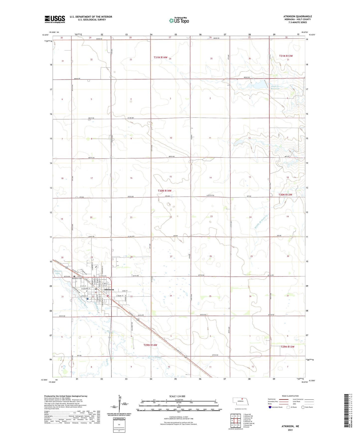
2021 topographic map quadrangle Atkinson in the state of Nebraska. Scale: 1:24000. Based on the newly updated USGS 7.5' US Topo map series, this map is in the following counties: Holt. The map contains contour data, water features, and other items you are used to seeing on USGS maps, but also has updated roads and other features. This is the next generation of topographic maps. Printed on high-quality waterproof paper with UV fade-resistant inks.
Quads adjacent to this one:
West: Stuart SE
Northwest: Stuart NE
North: Atkinson NW
Northeast: Atkinson NE
East: Atkinson SE
Southeast: Emmet
South: Emmet NW
Southwest: Lambs Lake NE
Contains the following named places: Atkinson, Atkinson Elementary School, Atkinson Fire and Rescue, Atkinson Good Samaritan Center, Atkinson Junior High School, Atkinson Lake Recreation Area, Atkinson Police Department, Atkinson Post Office, Atkinson Township Library, C O Grain Incorporated Elevator, City of Atkinson, Dry Creek, Eagle Creek Dam, Eagle Creek Reservoir, Faith Wesleyan Church, Grassland Grain and Irrigation Elevator, Immanuel Lutheran Church, Mill Race, Presbyterian Church, Reorganized Church of Latter Day Saints, Ridgeway Public School, Saint Johns Lutheran Church, Saint Joseph Elementary School, Saint Josephs Catholic Church, School Number 101, School Number 102, School Number 119, School Number 155, School Number 237, School Number 79, School Number 89, Sturdevant-McKee Museum, Township of Atkinson, Tri County Medical Clinic, United Methodist Church, Vogel Grain Elevator, West Holt Assembly of God Church, West Holt Medical Clinic, West Holt Memorial Hospital, West Holt Rural High School, Wheel Inn Motel/Campground, Woodlawn Cemetery, ZIP Code: 68713