MyTopo
Atlanta Nebraska US Topo Map
Couldn't load pickup availability
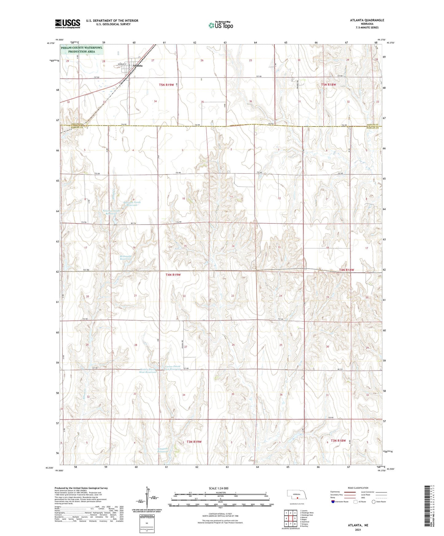
2021 topographic map quadrangle Atlanta in the state of Nebraska. Scale: 1:24000. Based on the newly updated USGS 7.5' US Topo map series, this map is in the following counties: Harlan, Phelps. The map contains contour data, water features, and other items you are used to seeing on USGS maps, but also has updated roads and other features. This is the next generation of topographic maps. Printed on high-quality waterproof paper with UV fade-resistant inks.
Quads adjacent to this one:
West: Mascot
Northwest: Loomis
North: Holdrege West
Northeast: Holdrege East
East: Ragan
Southeast: Huntley
South: Orleans
Southwest: Stamford
Contains the following named places: Atlanta, Atlanta Elevator, Atlanta Post Office, Atlanta United Methodist Church, Bethel Church, Carter-David East Dam, Carter-David East Reservoir, Carter-David West Dam, Carter-David West Reservoir, Einspahr Dam, Einspahr Reservoir, McDonald Dam, McDonald Reservoir, Milrose David Dam Number 2, Milrose David Reservoir Number 2, Peterson North Dam, Peterson North Reservoir, Peterson South Dam, Peterson South Reservoir, Township of Albany, Village of Atlanta, ZIP Code: 68923