MyTopo
Benkelman Nebraska US Topo Map
Couldn't load pickup availability
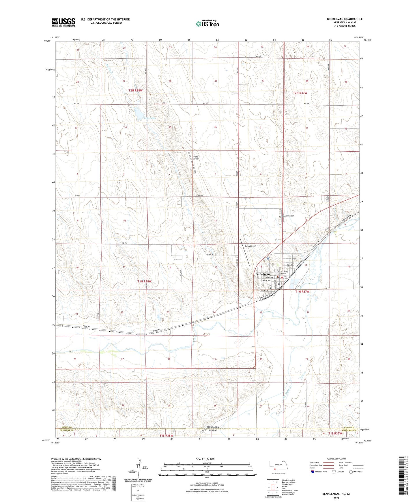
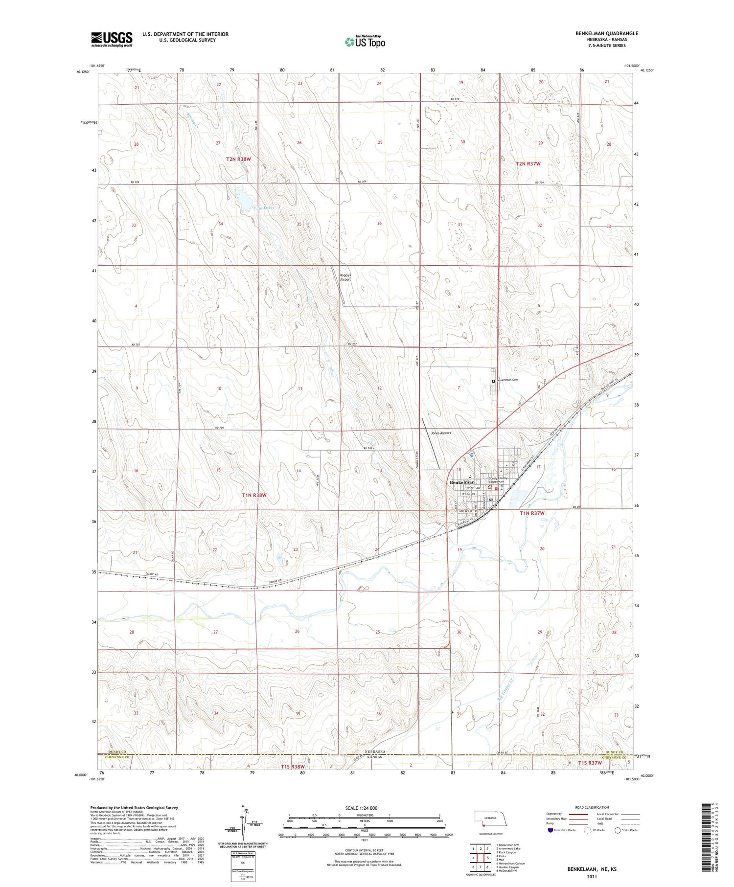
2021 topographic map quadrangle Benkelman in the state of Nebraska. Scale: 1:24000. Based on the newly updated USGS 7.5' US Topo map series, this map is in the following counties: Dundy, Cheyenne. The map contains contour data, water features, and other items you are used to seeing on USGS maps, but also has updated roads and other features. This is the next generation of topographic maps. Printed on high-quality waterproof paper with UV fade-resistant inks.
Quads adjacent to this one:
West: Parks
Northwest: Benkelman NW
North: Arrowhead Lake
Northeast: Rock Canyon
East: Max
Southeast: McDonald NW
South: Henkle Canyon
Southwest: Heinzelman Canyon
Contains the following named places: Baney Trailer Park, Barnes Creek, Benkelman, Benkelman Cemetery, Benkelman Elementary School, Benkelman Elevators, Benkelman Golf Club, Benkelman Police Department, Benkelman Post Office, Benkelman State Fish Hatchery, Benkelman Township, Benkelman Volunteer Fire Department, Benkelman Womans Club Library, Big Timber Creek, Burrows Vision Clinic, City of Benkelman, Doane, Doane School, Dundy County Ambulance Benkelman, Dundy County Courthouse, Dundy County Fairgrounds, Dundy County High School, Dundy County Hospital, Dundy County Hospital Clinic, Dundy County Museum, Friends Church, General Custer in Nebraska Historical Marker, Harvest Time Assembly of God Church, Hester Memorial Home, Hoppy's Airport, Jones Airport, Merklin Trailer Court, Rainbow Fountain Park, Republican River Family Clinic, Saint Josephs Catholic Church, South Fork Republican River, Spring Creek, Township of Benkelman, Trinity Baptist Church, Twin Forks Clinic Incorporated, Twin Lakes, United Methodist Church, United Presbyterian Church, Ward Bond Memorial Park, Zion Lutheran Church