MyTopo
Deloit Nebraska US Topo Map
Couldn't load pickup availability
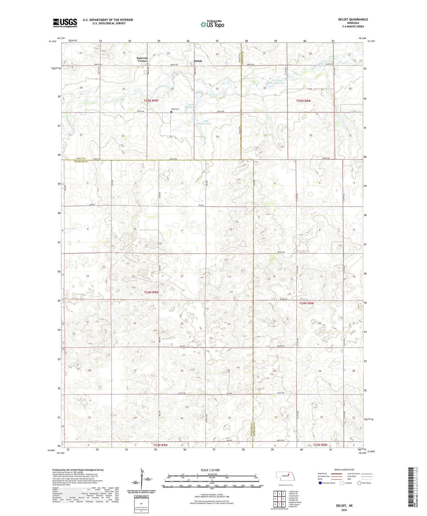
2021 topographic map quadrangle Deloit in the state of Nebraska. Scale: 1:24000. Based on the newly updated USGS 7.5' US Topo map series, this map is in the following counties: Wheeler, Antelope, Holt. The map contains contour data, water features, and other items you are used to seeing on USGS maps, but also has updated roads and other features. This is the next generation of topographic maps. Printed on high-quality waterproof paper with UV fade-resistant inks.
Quads adjacent to this one:
West: Deloit SW
Northwest: Deloit NW
North: Deloit NE
Northeast: Clearwater
East: Neligh SW
Southeast: Elgin NW
South: Park Church
Southwest: Mignery Ranch
Contains the following named places: Deloit, Deloit Post Office, Deloit School, Fairview Church, Funk Dam, Funk Reservoir, Knievels Corner, School Number 100, School Number 103, School Number 60, Sehi Dam, Sehi Reservoir, Sunnybrook Public School, Twiss Dam, Twiss Reservoir, Wolf Cemetery