MyTopo
Greeley Nebraska US Topo Map
Couldn't load pickup availability
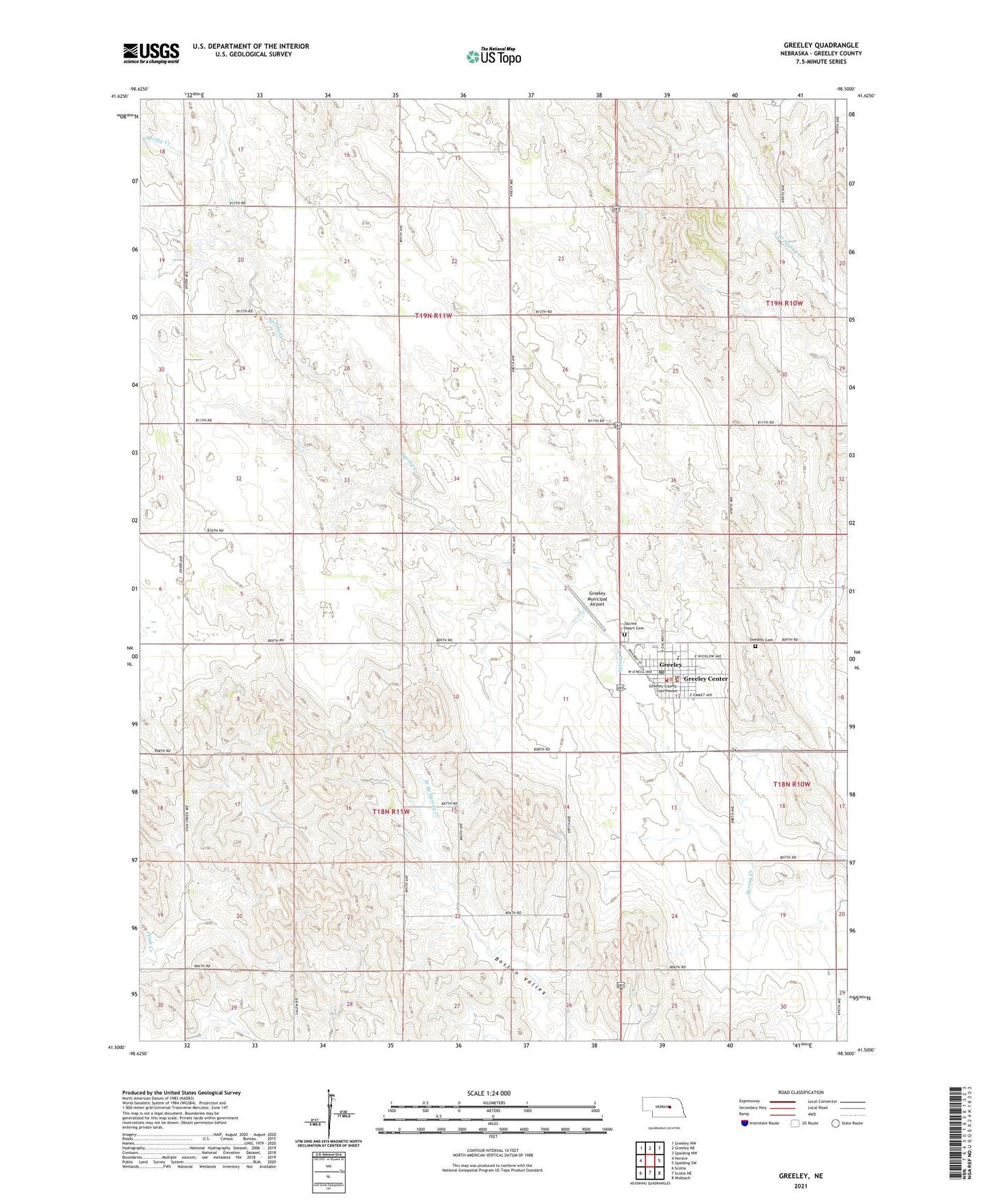
2021 topographic map quadrangle Greeley in the state of Nebraska. Scale: 1:24000. Based on the newly updated USGS 7.5' US Topo map series, this map is in the following counties: Greeley. The map contains contour data, water features, and other items you are used to seeing on USGS maps, but also has updated roads and other features. This is the next generation of topographic maps. Printed on high-quality waterproof paper with UV fade-resistant inks.
Quads adjacent to this one:
West: Horace
Northwest: Greeley NW
North: Greeley NE
Northeast: Spalding NW
East: Spalding SW
Southeast: Wolbach
South: Scotia NE
Southwest: Scotia
Contains the following named places: Boston Valley, Boston Valley School, Greeley, Greeley Care Home, Greeley County, Greeley County Courthouse, Greeley County Sheriff's Office, Greeley Election Precinct, Greeley Municipal Airport, Greeley Post Office, Greeley Public Library, Greeley Public Schools, Greeley Volunteer Fire and Rescue, Reed School, Sacred Heart Cemetery, Sacred Heart Church, Sacred Heart Elementary School, Saint Paul Family Medicine, School Number 19, School Number 40, School Number 54, Spalding Co-op Elevator, Star School, Swedish Cemetery, Township of Center, United Methodist Church, Village of Greeley Center, ZIP Code: 68842