MyTopo
Howe Nebraska US Topo Map
Couldn't load pickup availability
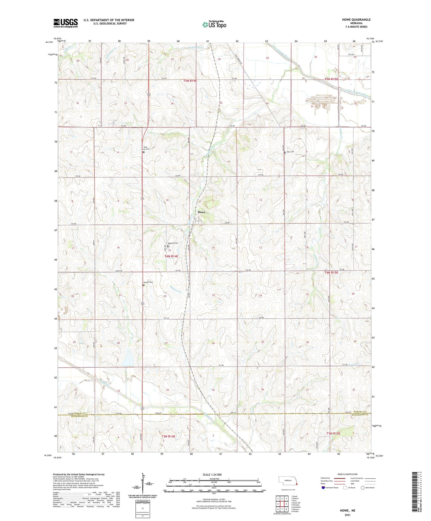
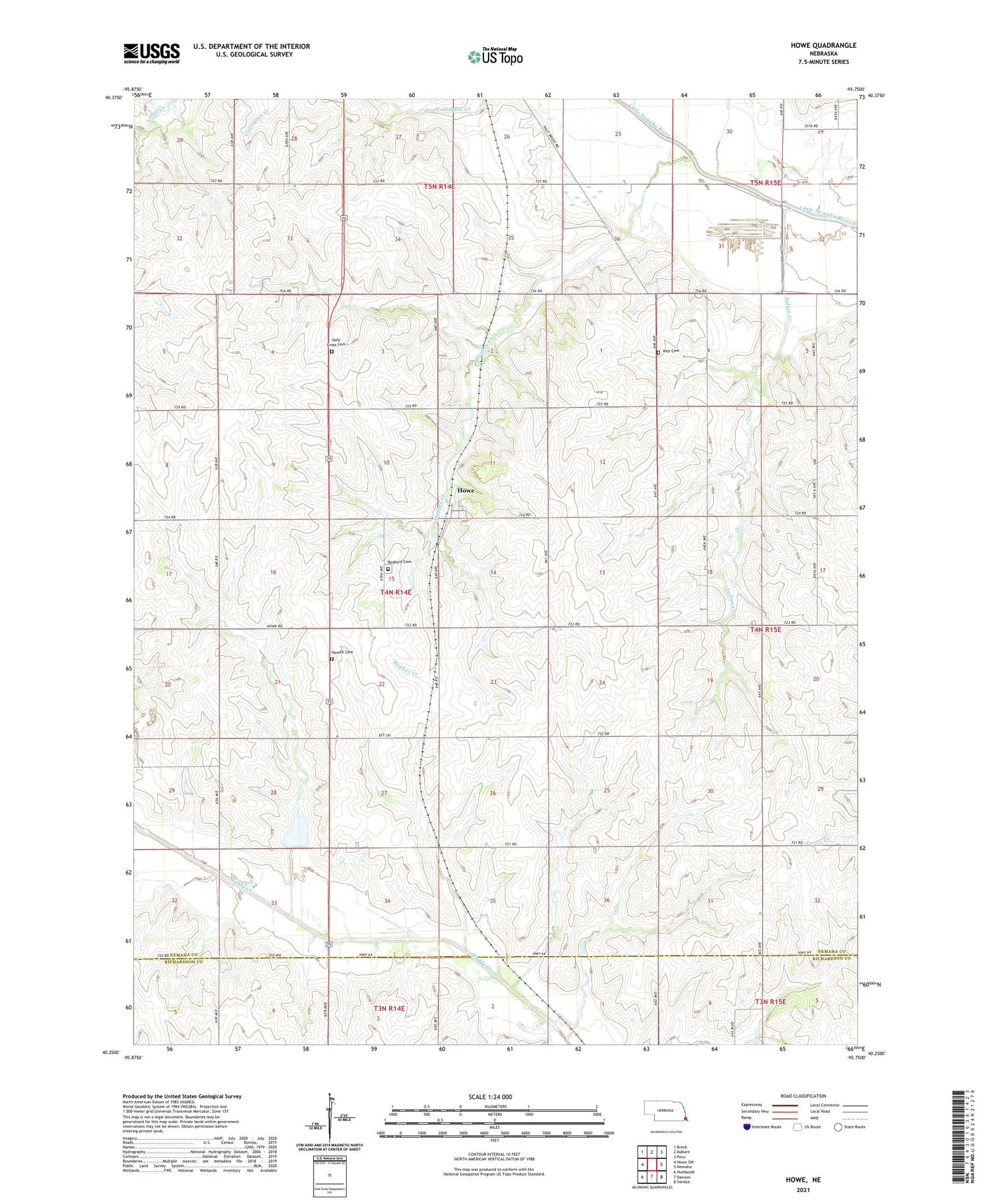
2021 topographic map quadrangle Howe in the state of Nebraska. Scale: 1:24000. Based on the newly updated USGS 7.5' US Topo map series, this map is in the following counties: Nemaha, Richardson. The map contains contour data, water features, and other items you are used to seeing on USGS maps, but also has updated roads and other features. This is the next generation of topographic maps. Printed on high-quality waterproof paper with UV fade-resistant inks.
Quads adjacent to this one:
West: Howe SW
Northwest: Brock
North: Auburn
Northeast: Peru
East: Nemaha
Southeast: Verdon
South: Dawson
Southwest: Humboldt
Contains the following named places: Auburn Country Club, Bedford Cemetery, Bedford Election Precinct, Bergmann Dam, Bergmann Reservoir, Cockran School, Fairview School, Holy Cross Cemetery, Howe, Howe Post Office, Howell Cemetery, Hughes Creek, Indian Creek, Kite Cemetery, Muddy Creek Dam Number 10, Muddy Creek Reservoir Number 10, Scotch Branch, Township of Bedford, ZIP Code: 68305