MyTopo
Indian Hill Nebraska US Topo Map
Couldn't load pickup availability
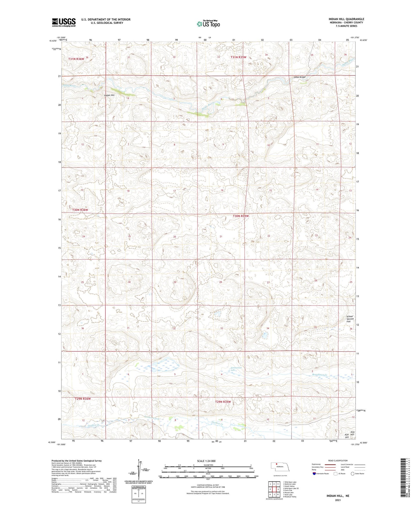
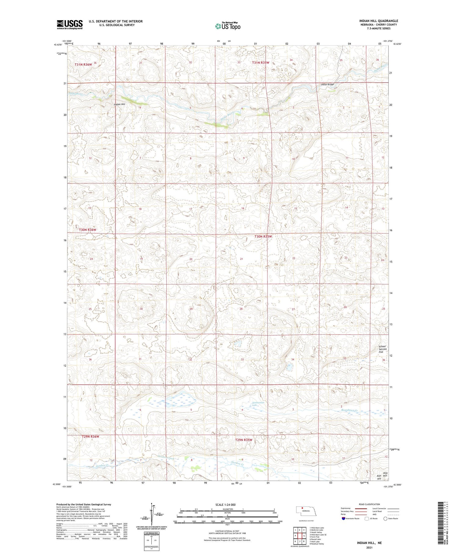
2021 topographic map quadrangle Indian Hill in the state of Nebraska. Scale: 1:24000. Based on the newly updated USGS 7.5' US Topo map series, this map is in the following counties: Cherry. The map contains contour data, water features, and other items you are used to seeing on USGS maps, but also has updated roads and other features. This is the next generation of topographic maps. Printed on high-quality waterproof paper with UV fade-resistant inks.
Quads adjacent to this one:
West: Wild Mare Lake SE
Northwest: Wild Mare Lake
North: Medicine Lake
Northeast: Heath Valley
East: Farm Flat
Southeast: Rosebud Valley
South: Wolf Lake
Southwest: Round Lake
Contains the following named places: Aljo Hill, Devils Hole, Gillaspie Election Precinct, Indian Bridge, Indian Hill, Kime Rinch, School Number 83, Zimmerman Lake