MyTopo
Loomis Nebraska US Topo Map
Couldn't load pickup availability
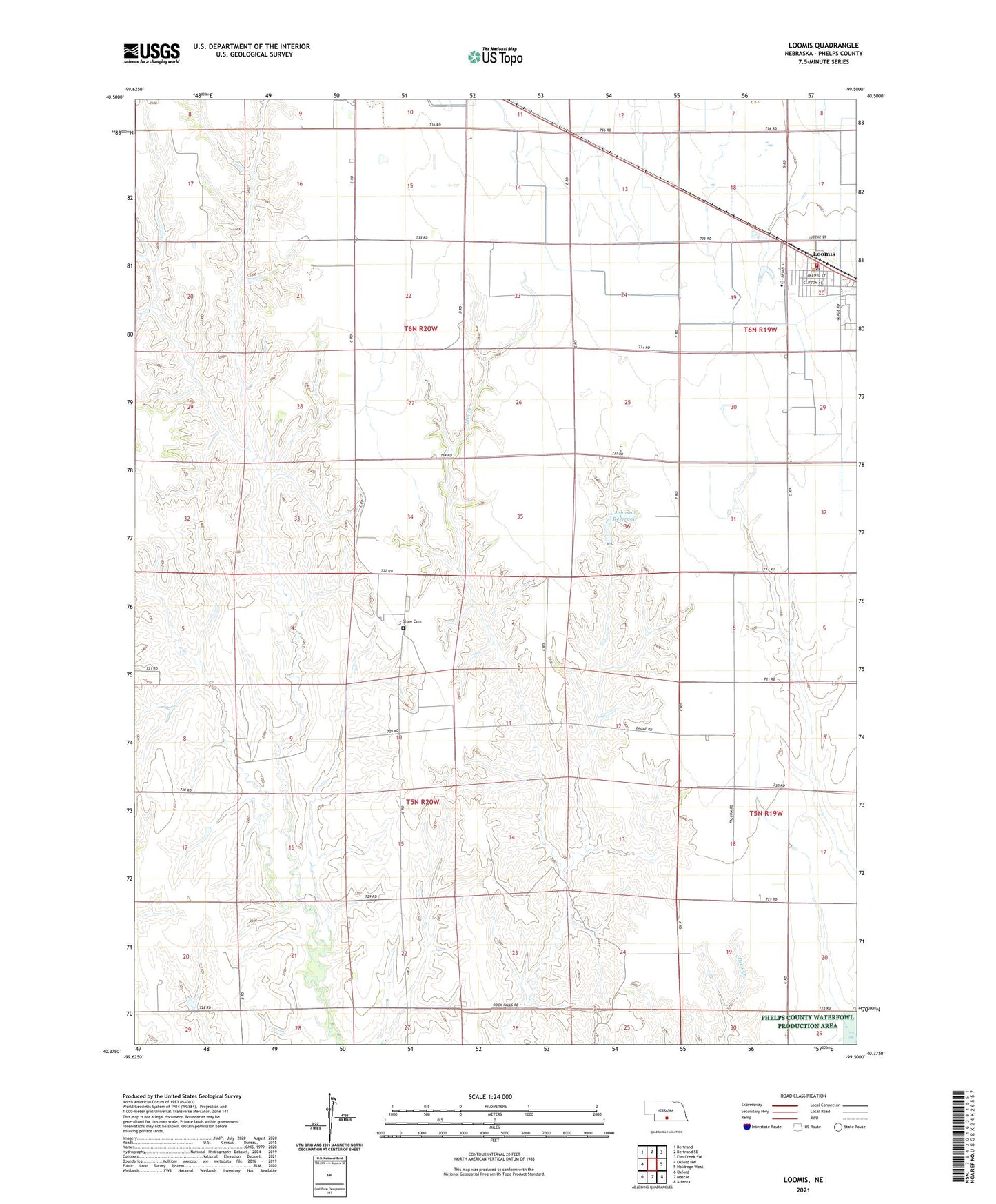
2021 topographic map quadrangle Loomis in the state of Nebraska. Scale: 1:24000. Based on the newly updated USGS 7.5' US Topo map series, this map is in the following counties: Phelps. The map contains contour data, water features, and other items you are used to seeing on USGS maps, but also has updated roads and other features. This is the next generation of topographic maps. Printed on high-quality waterproof paper with UV fade-resistant inks.
Quads adjacent to this one:
West: Oxford NW
Northwest: Bertrand
North: Bertrand SE
Northeast: Elm Creek SW
East: Holdrege West
Southeast: Atlanta
South: Mascot
Southwest: Oxford
Contains the following named places: Agri Coop Elevator, Election Precinct 7, Johnson Dam-1 Dam, Johnson Reservoir, Linder Stock Farms, Loomis, Loomis Evangelical Free Church, Loomis Post Office, Loomis Public Schools, Loomis United Methodist Church, Loomis Volunteer Fire and Rescue, Shaw Cemetery, Township of Industry-Rock Falls, Township of Union, Village of Loomis