MyTopo
Minden South Nebraska US Topo Map
Couldn't load pickup availability
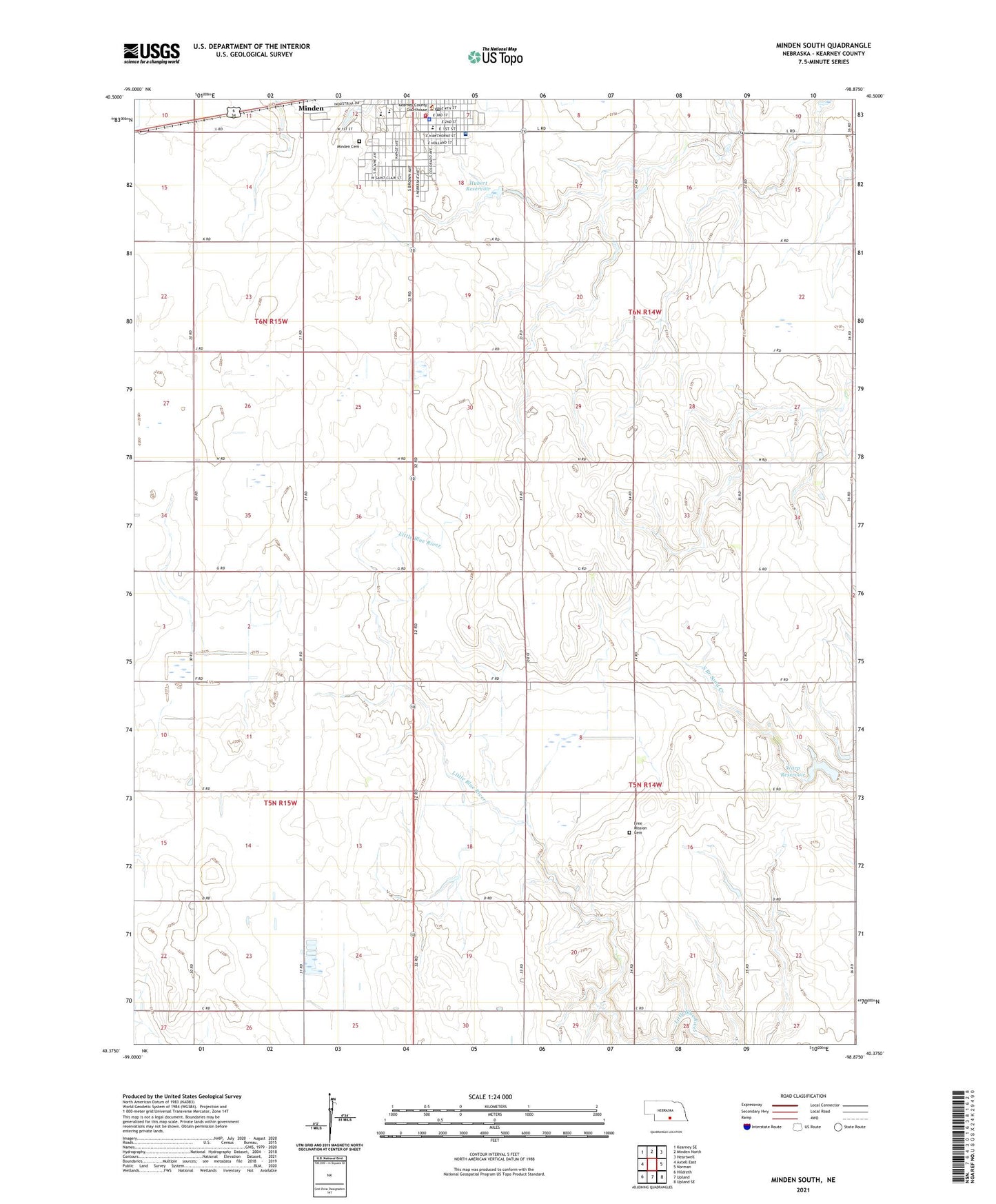
2021 topographic map quadrangle Minden South in the state of Nebraska. Scale: 1:24000. Based on the newly updated USGS 7.5' US Topo map series, this map is in the following counties: Kearney. The map contains contour data, water features, and other items you are used to seeing on USGS maps, but also has updated roads and other features. This is the next generation of topographic maps. Printed on high-quality waterproof paper with UV fade-resistant inks.
Quads adjacent to this one:
West: Axtell East
Northwest: Kearney SE
North: Minden North
Northeast: Heartwell
East: Norman
Southeast: Upland SE
South: Upland
Southwest: Hildreth
Contains the following named places: Bethany Lutheran Church, C L Jones Middle School, City of Minden, Countryside Mobile Home Park, First Christian Church, Fredericksburg Post Office, Fredricksburg Church, Free Mission Cemetery, Hubert Dam, Hubert Reservoir, Jensen Memorial Library, Kearney County Courthouse, Kearney County Emergency Management Agency, Kearney County Health Services, Kearney County Sheriff Office, Minden, Minden Cemetery, Minden Dental Clinic, Minden East Elementary School, Minden Eye Clinic, Minden High School, Minden Medical Clinic, Minden Police Department, Minden Post Office, Minden Volunteer Fire Department, Northeast Sacramento State Wildlife Management Area, Saint Paul Lutheran Church, South Side Mobile Home Court, Township of Cosmo, Township of Lincoln, United Methodist Church, Warp Dam, Warp Reservoir, Westminster United Presbyterian Church, Willowbrook Center for Mental Health and Wellness, ZIP Code: 68959