MyTopo
Oxford Nebraska US Topo Map
Couldn't load pickup availability
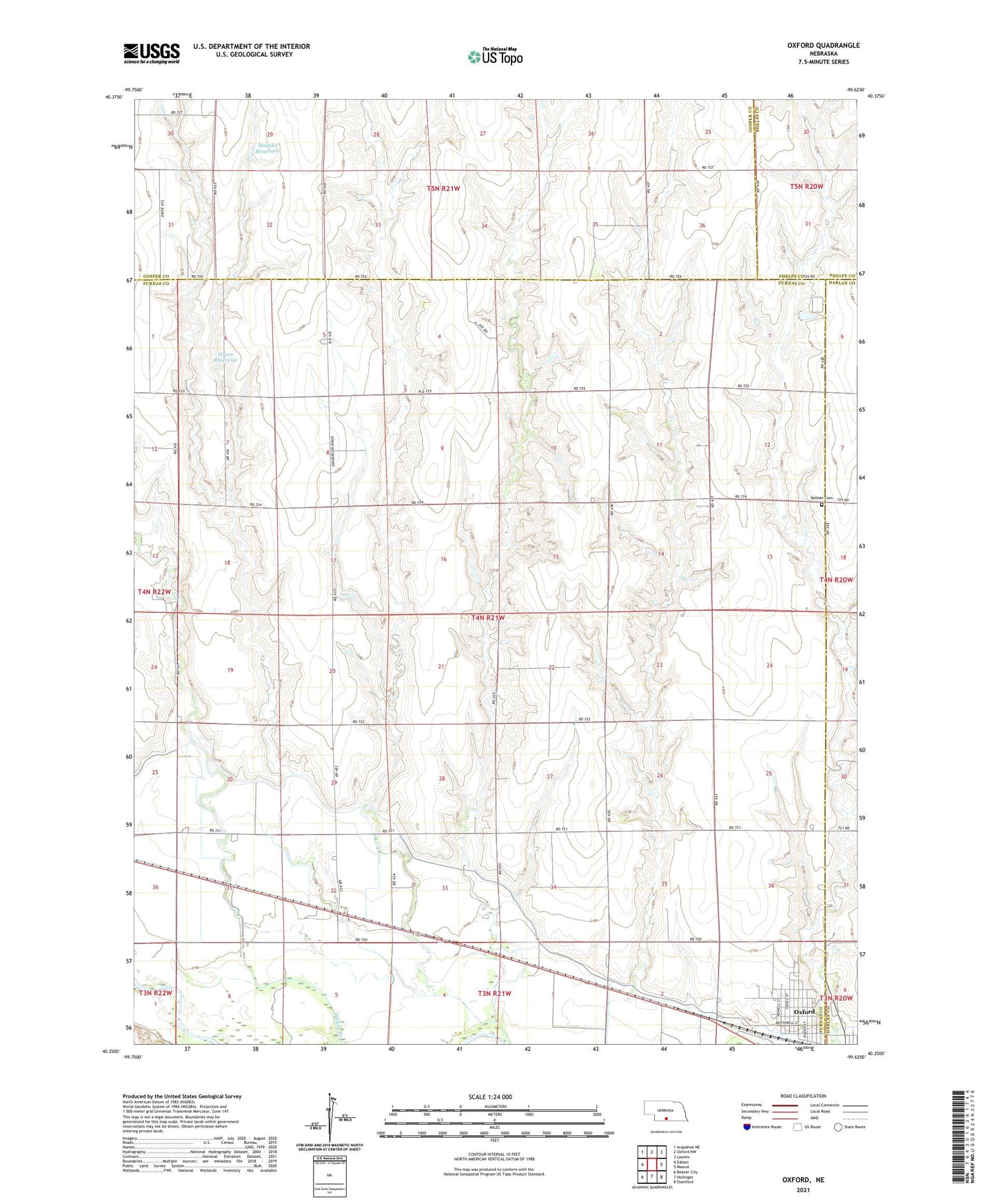
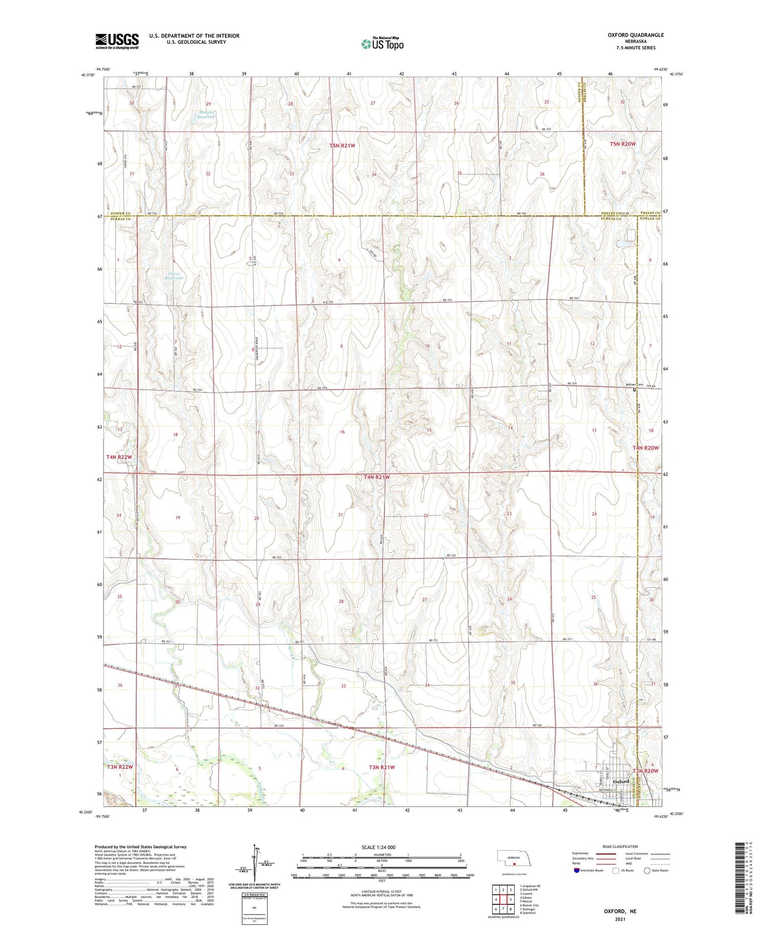
2021 topographic map quadrangle Oxford in the state of Nebraska. Scale: 1:24000. Based on the newly updated USGS 7.5' US Topo map series, this map is in the following counties: Furnas, Gosper, Harlan, Phelps. The map contains contour data, water features, and other items you are used to seeing on USGS maps, but also has updated roads and other features. This is the next generation of topographic maps. Printed on high-quality waterproof paper with UV fade-resistant inks.
Quads adjacent to this one:
West: Edison
Northwest: Arapahoe NE
North: Oxford NW
Northeast: Loomis
East: Mascot
Southeast: Stamford
South: Hollinger
Southwest: Beaver City
Contains the following named places: Buffalo School, Cambridge Canal, Cardinal Country Club, First Baptist Church, Grove Dam, Grove Reservoir, Hardscrabble School, Kellner Cemetery, Maaske Dam, Maaske Reservoir, New Era Election Precinct, New Era School, Oxford Dental Clinic, Oxford Elementary School, Oxford Evangelical Free Church, Oxford Medical Clinic, Oxford Municipal Airport, Oxford Public Library, Oxford State Wildlife Management Area, Republican River Flood of 1935 Historical Marker, Saint Johns Lutheran Church, Saint Michaels Catholic Church, Swartz Creek, Township of New Era, Union Church, United Methodist Church, Village of Oxford, Walker Post Manor