MyTopo
Palisade Nebraska US Topo Map
Couldn't load pickup availability
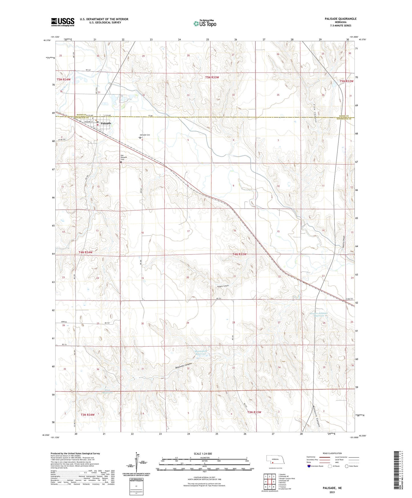
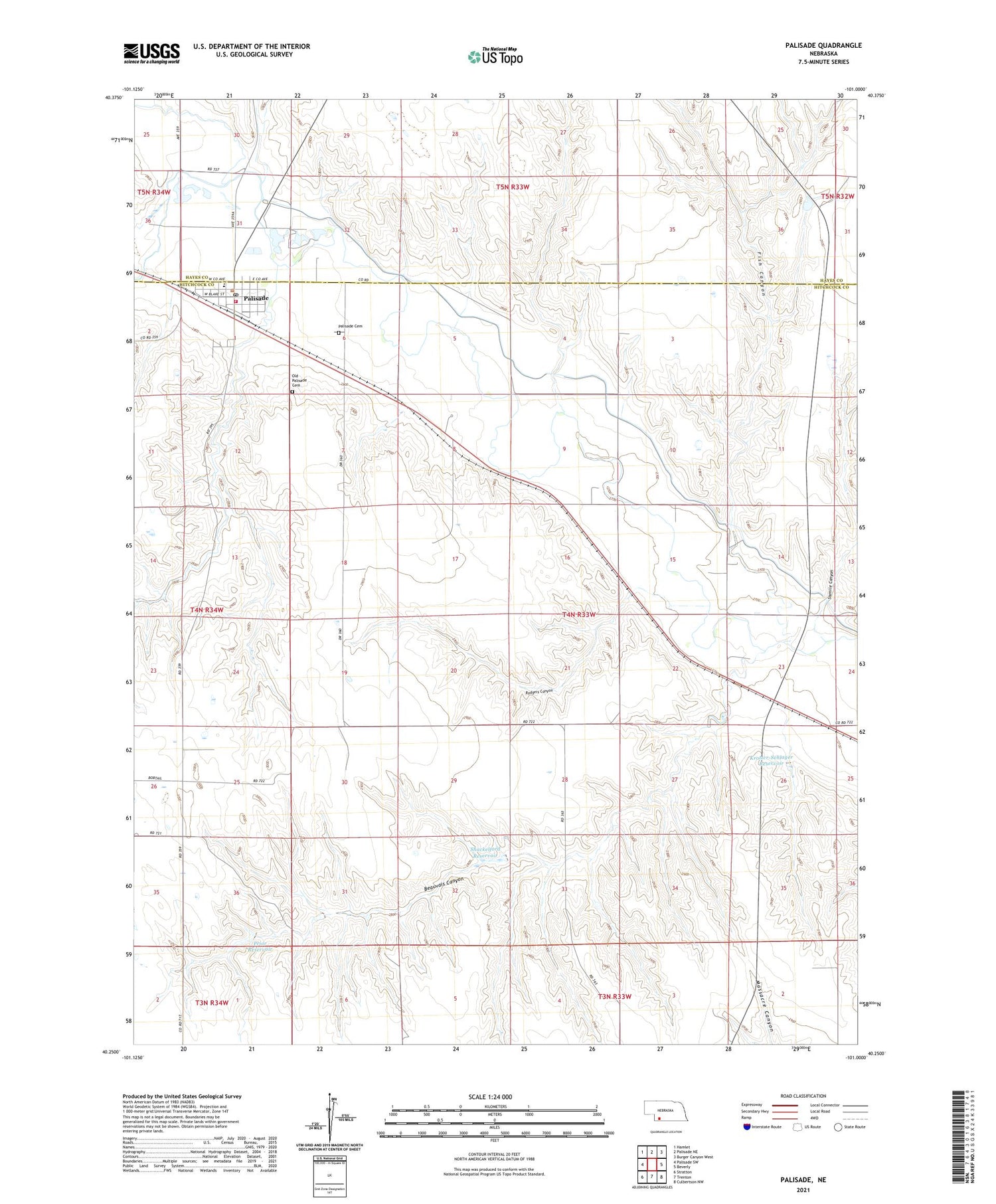
2021 topographic map quadrangle Palisade in the state of Nebraska. Scale: 1:24000. Based on the newly updated USGS 7.5' US Topo map series, this map is in the following counties: Hitchcock, Hayes. The map contains contour data, water features, and other items you are used to seeing on USGS maps, but also has updated roads and other features. This is the next generation of topographic maps. Printed on high-quality waterproof paper with UV fade-resistant inks.
Quads adjacent to this one:
West: Palisade SW
Northwest: Hamlet
North: Palisade NE
Northeast: Burger Canyon West
East: Beverly
Southeast: Culbertson NW
South: Trenton
Southwest: Stratton
Contains the following named places: Beauvais Canyon, Beverly Election Precinct, Bobtail Creek, Carse Dam, Carse Reservoir, Centennial Park, Culbertson Dam, Fish Canyon, Krotter Canal, Krotter-Schlager Dam, Krotter-Schlager Reservoir, Old Palisade Cemetery, Palisade, Palisade Cemetery, Palisade City Park, Palisade Elevator, Palisade Fire and Rescue, Palisade Post Office, Palisade Public Library, Palisade United Methodist Church, Prior Dam, Prior Reservoir, Rodgers Canyon, Shackelford Dam, Shackelford Reservoir, Sixmile Canyon, Smith Trailer Court, Stinking Water Creek, Trinity Lutheran Church, Village of Palisade, Wauneta Palisade Junior High School