MyTopo
Palmyra Nebraska US Topo Map
Couldn't load pickup availability
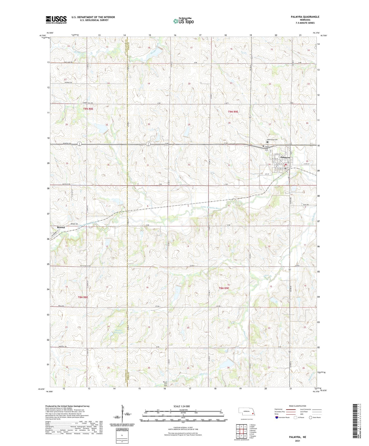
2021 topographic map quadrangle Palmyra in the state of Nebraska. Scale: 1:24000. Based on the newly updated USGS 7.5' US Topo map series, this map is in the following counties: Otoe, Lancaster. The map contains contour data, water features, and other items you are used to seeing on USGS maps, but also has updated roads and other features. This is the next generation of topographic maps. Printed on high-quality waterproof paper with UV fade-resistant inks.
Quads adjacent to this one:
West: Bennet
Northwest: Walton
North: Eagle
Northeast: Elmwood
East: Unadilla
Southeast: Burr
South: Douglas
Southwest: Firth
Contains the following named places: Clearidge Airport, Farmers Cooperative Company Elevator, Mueller Dam, Mueller Reservoir, North Palmyra Election Precinct, Palmyra, Palmyra Election Precinct, Palmyra Fire and Rescue, Palmyra Junior-Senior High School, Palmyra Memorial Library, Palmyra Post Office, Palmyra RV Camp, Rosewood Cemetery, Saint Leo Catholic Church, Saint Leos Cemetery, South Palmyra Election Precinct, Township of North Palmyra, Township of South Palmyra, Triple Creek State Wildlife Management Area, Village of Palmyra, ZIP Code: 68418