
MyTopo
Stapleton Nebraska US Topo Map
Couldn't load pickup availability
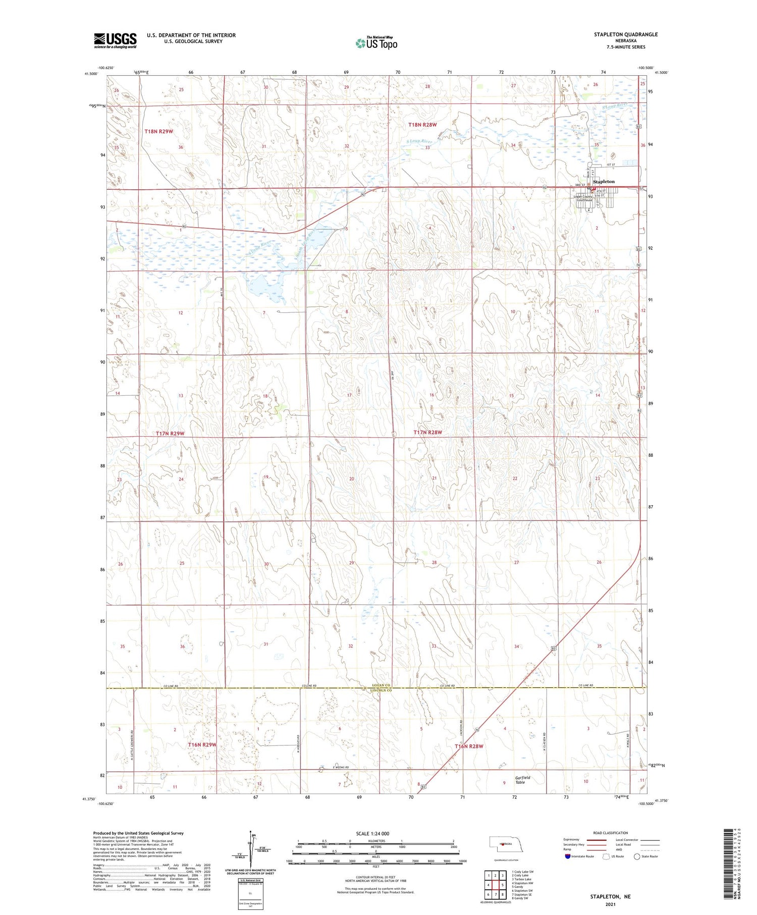
2021 topographic map quadrangle Stapleton in the state of Nebraska. Scale: 1:24000. Based on the newly updated USGS 7.5' US Topo map series, this map is in the following counties: Logan, Lincoln. The map contains contour data, water features, and other items you are used to seeing on USGS maps, but also has updated roads and other features. This is the next generation of topographic maps. Printed on high-quality waterproof paper with UV fade-resistant inks.
Quads adjacent to this one:
West: Stapleton NW
Northwest: Cody Lake SW
North: Cody Lake
Northeast: Tarbox Lake
East: Gandy
Southeast: Gandy SW
South: Stapleton SE
Southwest: Stapleton SW
Contains the following named places: Baskin Ranch Landing Strip, Garfield Table, Logan County Fair Exhibit Hall, Logan County Library, Logan County Sheriff's Office, Saint Johns Catholic Church, Stapleton, Stapleton Number 2 Election Precinct, Stapleton Post Office, Stapleton Presbyterian Church, Stapleton Public Schools, Stapleton Volunteer Fire Department, Village of Stapleton, Wilcox Ranch


