MyTopo
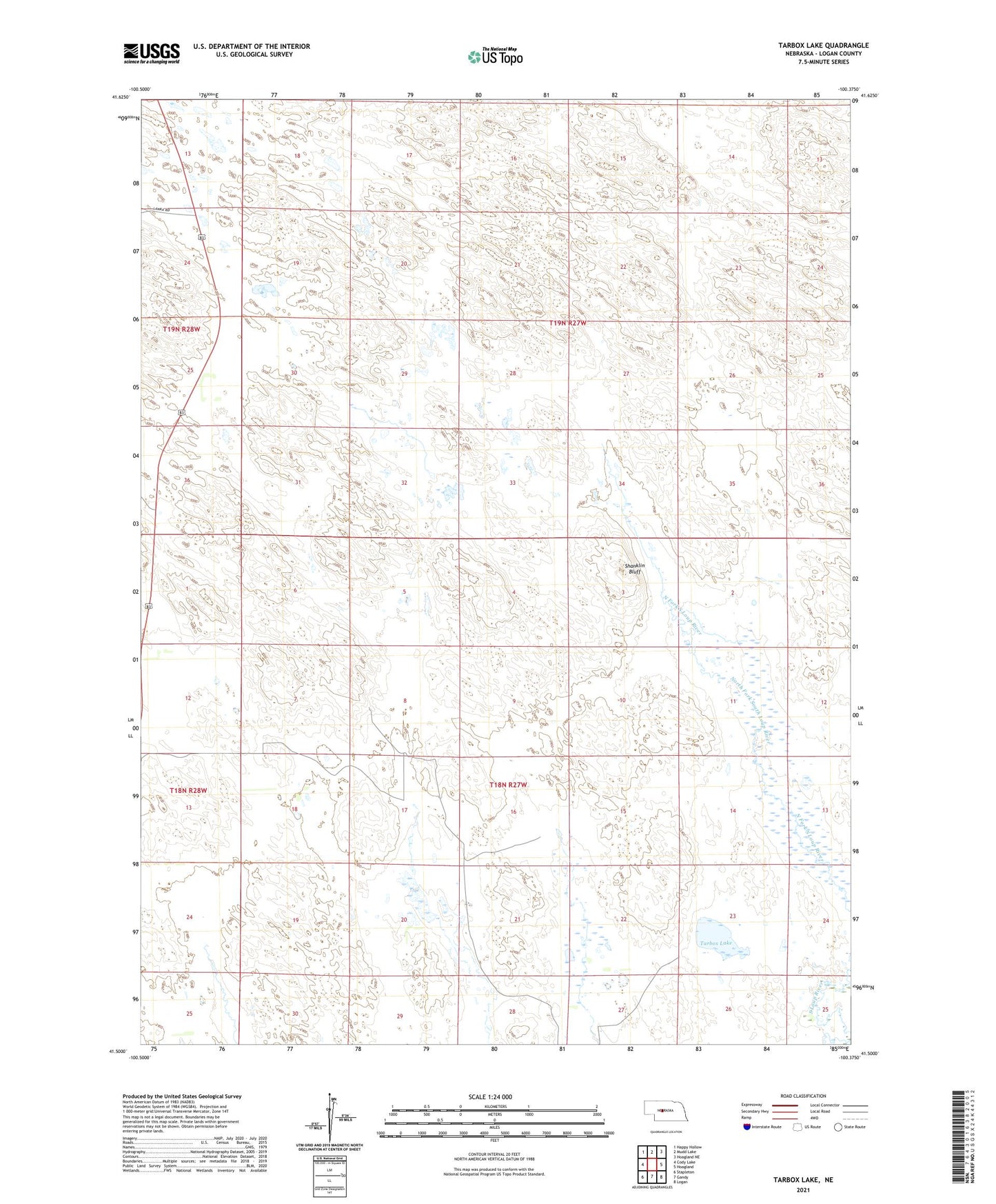
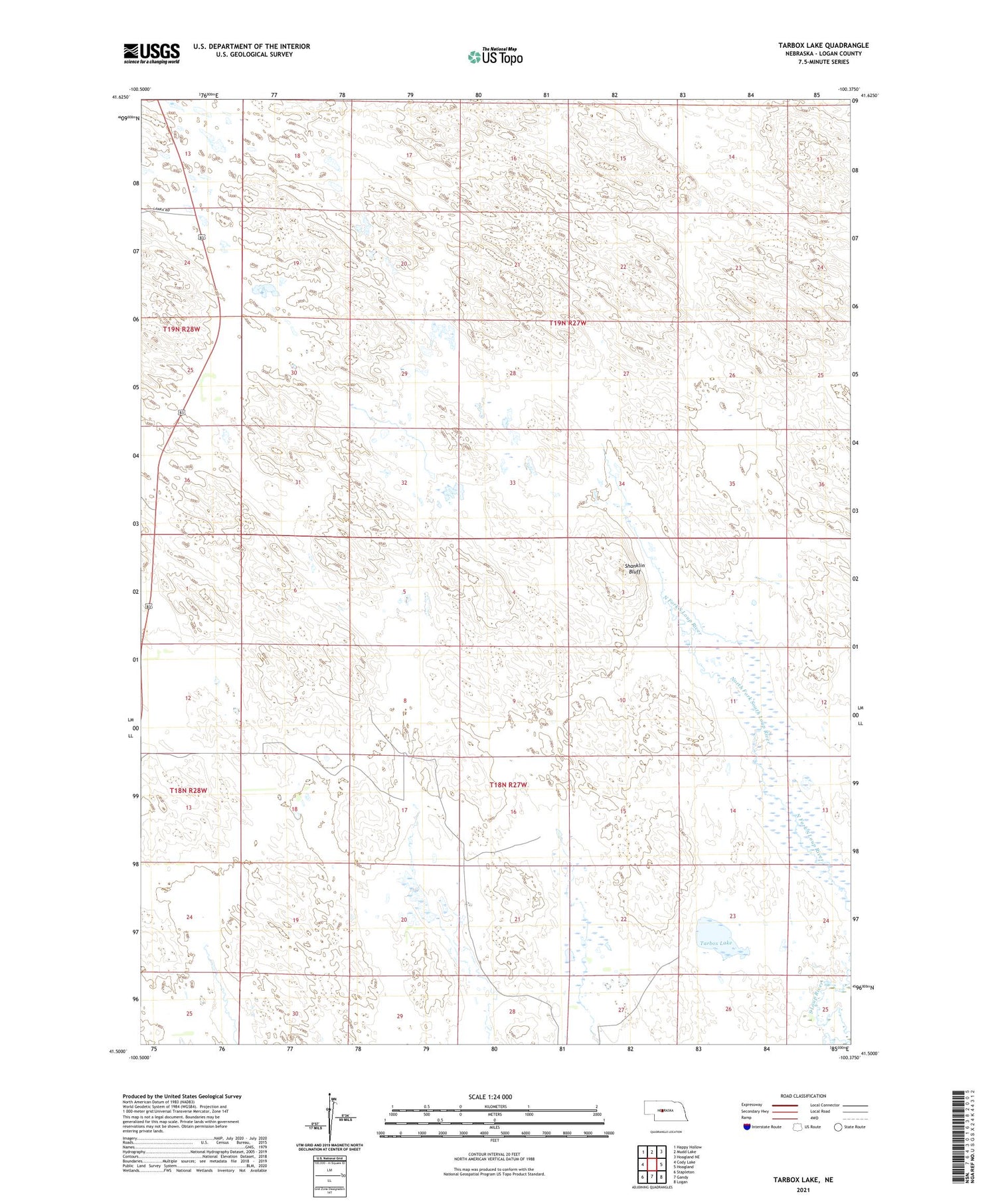
Tarbox Lake Nebraska US Topo Map
Couldn't load pickup availability
2021 topographic map quadrangle Tarbox Lake in the state of Nebraska. Scale: 1:24000. Based on the newly updated USGS 7.5' US Topo map series, this map is in the following counties: Logan. The map contains contour data, water features, and other items you are used to seeing on USGS maps, but also has updated roads and other features. This is the next generation of topographic maps. Printed on high-quality waterproof paper with UV fade-resistant inks.
Quads adjacent to this one:
West: Cody Lake
Northwest: Happy Hollow
North: Mudd Lake
Northeast: Hoagland NE
East: Hoagland
Southeast: Logan
South: Gandy
Southwest: Stapleton
Contains the following named places: Logan County, Logan Election Precinct, Miles Ranch, Shanklin Bluff, Tarbox Lake