MyTopo
Tobias SW Nebraska US Topo Map
Couldn't load pickup availability
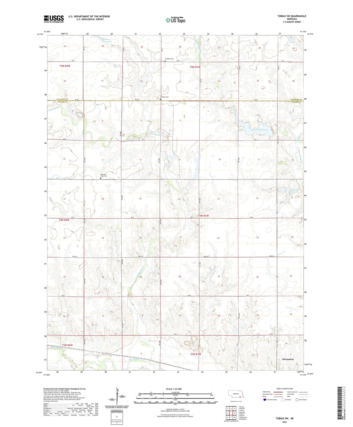
2021 topographic map quadrangle Tobias SW in the state of Nebraska. Scale: 1:24000. Based on the newly updated USGS 7.5' US Topo map series, this map is in the following counties: Thayer, Fillmore. The map contains contour data, water features, and other items you are used to seeing on USGS maps, but also has updated roads and other features. This is the next generation of topographic maps. Printed on high-quality waterproof paper with UV fade-resistant inks.
Quads adjacent to this one:
West: Bruning
Northwest: Strang
North: Ohiowa
Northeast: Tobias
East: Daykin
Southeast: Gladstone
South: Alexandria
Southwest: Hebron
Contains the following named places: Antioch Cemetery, Bruning Army Air Base, Bruning Army Air Field Historical Marker, Dry Sandy Creek, Excelsior School, Franklin Cemetery, Hawks Field, Highland-Alexandria Election Precinct, Kerwood Dam, Kerwood Reservoir, Medlar School, Mid - America Feed Yard, Olive Branch School, Pleasant Plain Cemetery, Pleasant Plain School, School Number 21, Sieber Dam, Sieber Reservoir, Square Top School, Township of Highland, Walnut Creek, Yoachim School, ZIP Code: 68303