
MyTopo
Angel Peak Nevada US Topo Map
Couldn't load pickup availability
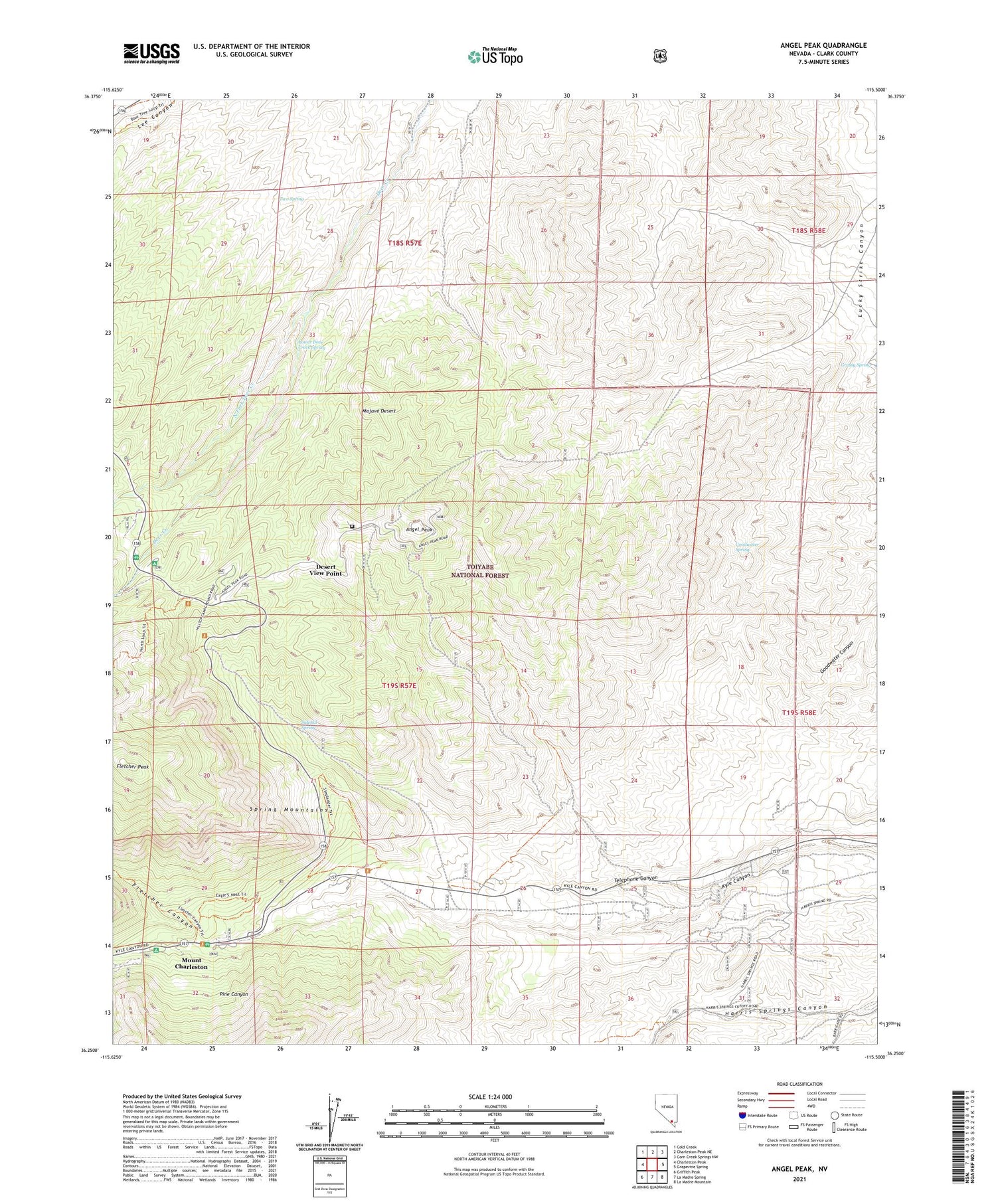
2021 topographic map quadrangle Angel Peak in the state of Nevada. Scale: 1:24000. Based on the newly updated USGS 7.5' US Topo map series, this map is in the following counties: Clark. The map contains contour data, water features, and other items you are used to seeing on USGS maps, but also has updated roads and other features. This is the next generation of topographic maps. Printed on high-quality waterproof paper with UV fade-resistant inks.
Quads adjacent to this one:
West: Charleston Peak
Northwest: Cold Creek
North: Charleston Peak NE
Southeast: La Madre Mountain
South: La Madre Spring
Southwest: Griffith Peak
Contains the following named places: Angel Peak, Charleston Mining District, Deer Creek Picnic Area, Desert View Point, Fletcher Canyon, Fletcher Peak, Fletcher View Campground, Goodwater Spring, Grassy Spring, Hilltop Campground, Kyle Canyon Campground, Kyle Canyon Ranger Station, Kyle Canyon RV Camp, Kyles Saw Mill, Las Vegas Air Force Station, Lower Deer Creek Spring, Lucky Strike Mine, Mahogany Grove Picnic Area, Mount Charleston Census Designated Place, Mount Charleston North Trailhead, North Fork Deer Creek, Pine Canyon, Sidehill Spring, Spring Mountain Youth Camp, Telephone Canyon, Two Spring


