MyTopo
Carrara Canyon Nevada US Topo Map
Couldn't load pickup availability
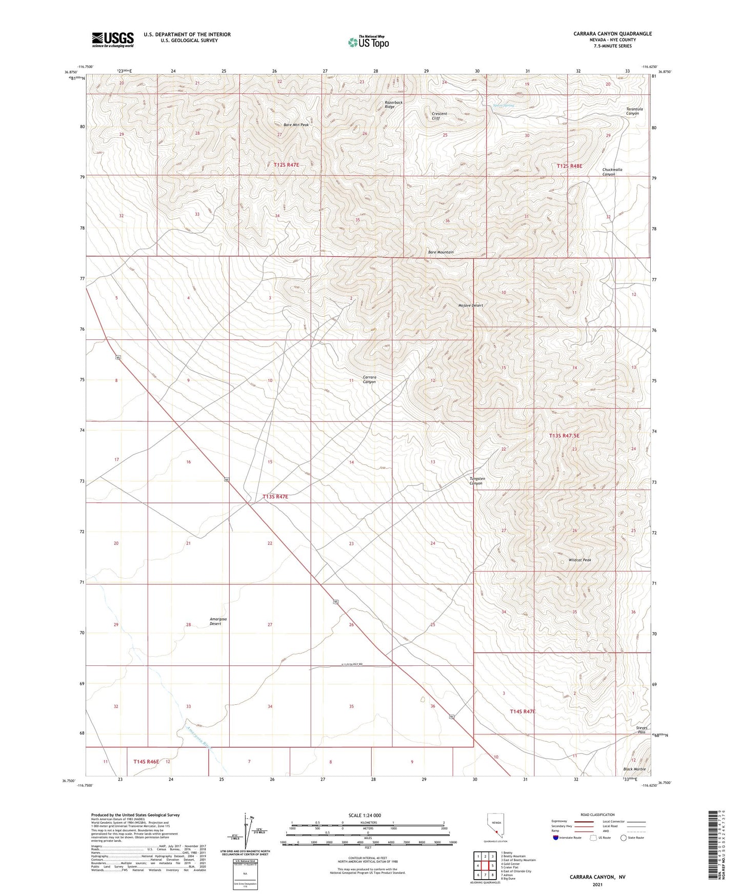
2021 topographic map quadrangle Carrara Canyon in the state of Nevada. Scale: 1:24000. Based on the newly updated USGS 7.5' US Topo map series, this map is in the following counties: Nye. The map contains contour data, water features, and other items you are used to seeing on USGS maps, but also has updated roads and other features. This is the next generation of topographic maps. Printed on high-quality waterproof paper with UV fade-resistant inks.
Quads adjacent to this one:
West: Gold Center
Northwest: Beatty
East: Crater Flat
Southeast: Big Dune
South: Ashton
Southwest: East of Chloride City
Contains the following named places: Arista Mine, Bare Mountain, Bare Mountain Peak, Black Marble, Carrara, Carrara Canyon, Carrara Post Office, Carrara Station, Chloride, Chuckwalla Canyon, Crescent Cliff, Diamond Queen Mine, Elizalde Company, Gold Ace Mine, Grand Junction Mine, Mexican Mine, Panama Mine, Razorback Ridge, Specie Spring, Steves Pass, Tarantula Canyon, Tungsten Canyon, Wildcat Peak