
MyTopo
Charleston Peak NE Nevada US Topo Map
Regular price
$16.95
Regular price
Sale price
$16.95
Unit price
per
Couldn't load pickup availability
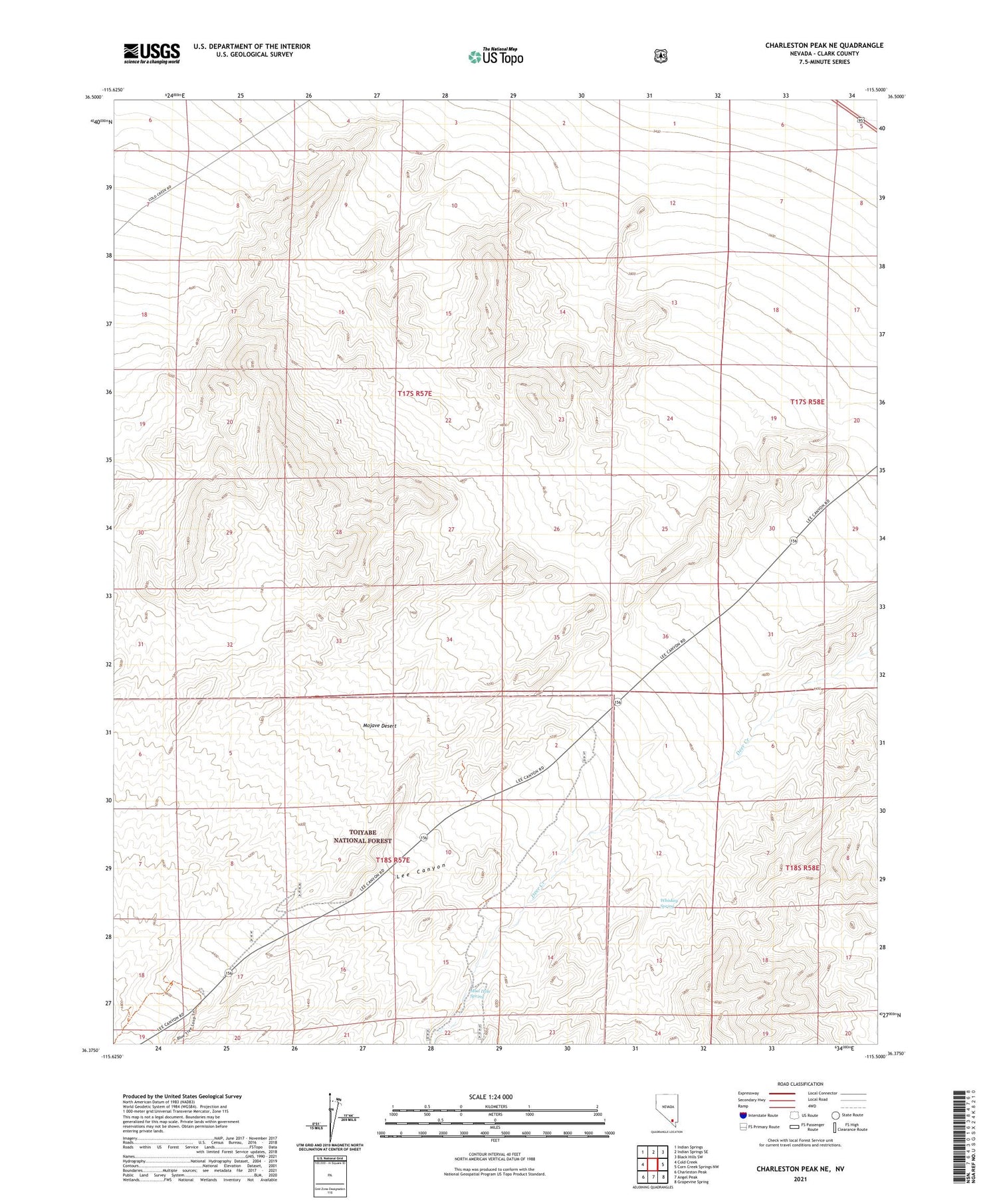
2021 topographic map quadrangle Charleston Peak NE in the state of Nevada. Scale: 1:24000. Based on the newly updated USGS 7.5' US Topo map series, this map is in the following counties: Clark. The map contains contour data, water features, and other items you are used to seeing on USGS maps, but also has updated roads and other features. This is the next generation of topographic maps. Printed on high-quality waterproof paper with UV fade-resistant inks.
Quads adjacent to this one:
West: Cold Creek
South: Angel Peak
Southwest: Charleston Peak
Contains the following named places: Desert View Natural Environment Area, Lee Canyon, Mud Hole Spring, Whiskey Spring, ZIP Code: 89166


