
MyTopo
Clear Creek Ranch Nevada US Topo Map
Couldn't load pickup availability
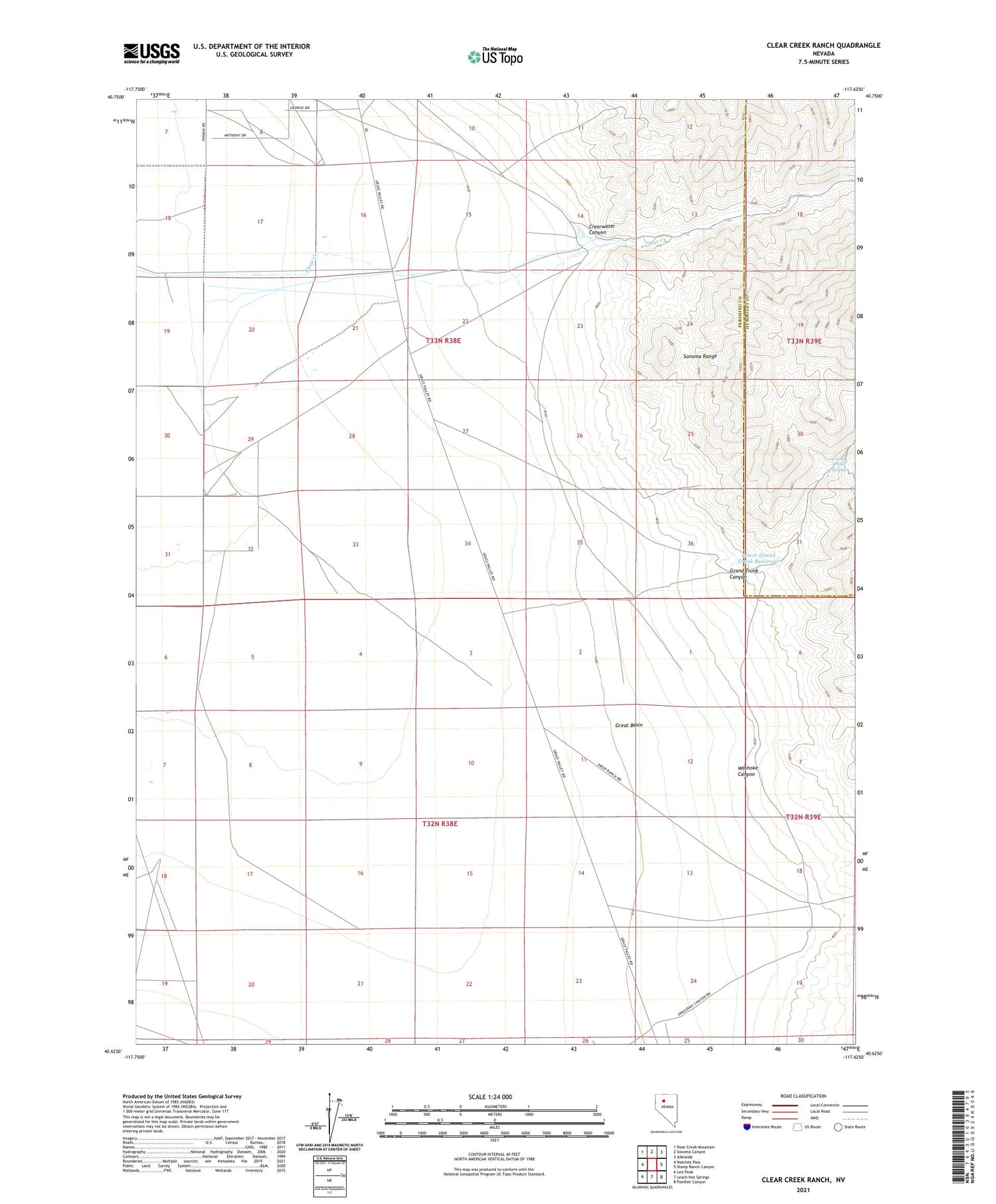
2021 topographic map quadrangle Clear Creek Ranch in the state of Nevada. Scale: 1:24000. Based on the newly updated USGS 7.5' US Topo map series, this map is in the following counties: Pershing, Humboldt. The map contains contour data, water features, and other items you are used to seeing on USGS maps, but also has updated roads and other features. This is the next generation of topographic maps. Printed on high-quality waterproof paper with UV fade-resistant inks.
Quads adjacent to this one:
West: Natchez Pass
Northwest: Rose Creek Mountain
North: Sonoma Canyon
Northeast: Adelaide
East: Sheep Ranch Canyon
Southeast: Panther Canyon
South: Leach Hot Springs
Southwest: Lee Peak
Contains the following named places: Clear Creek Ranch, Clearwater Canyon, Grand Trunk Canyon, Grand Trunk Spring, Great Basin, Lower Grand Trunk Reservoir, Washiki Group Mine, Washiki Mining District, Washoke Canyon


