MyTopo
Moapa West Nevada US Topo Map
Couldn't load pickup availability
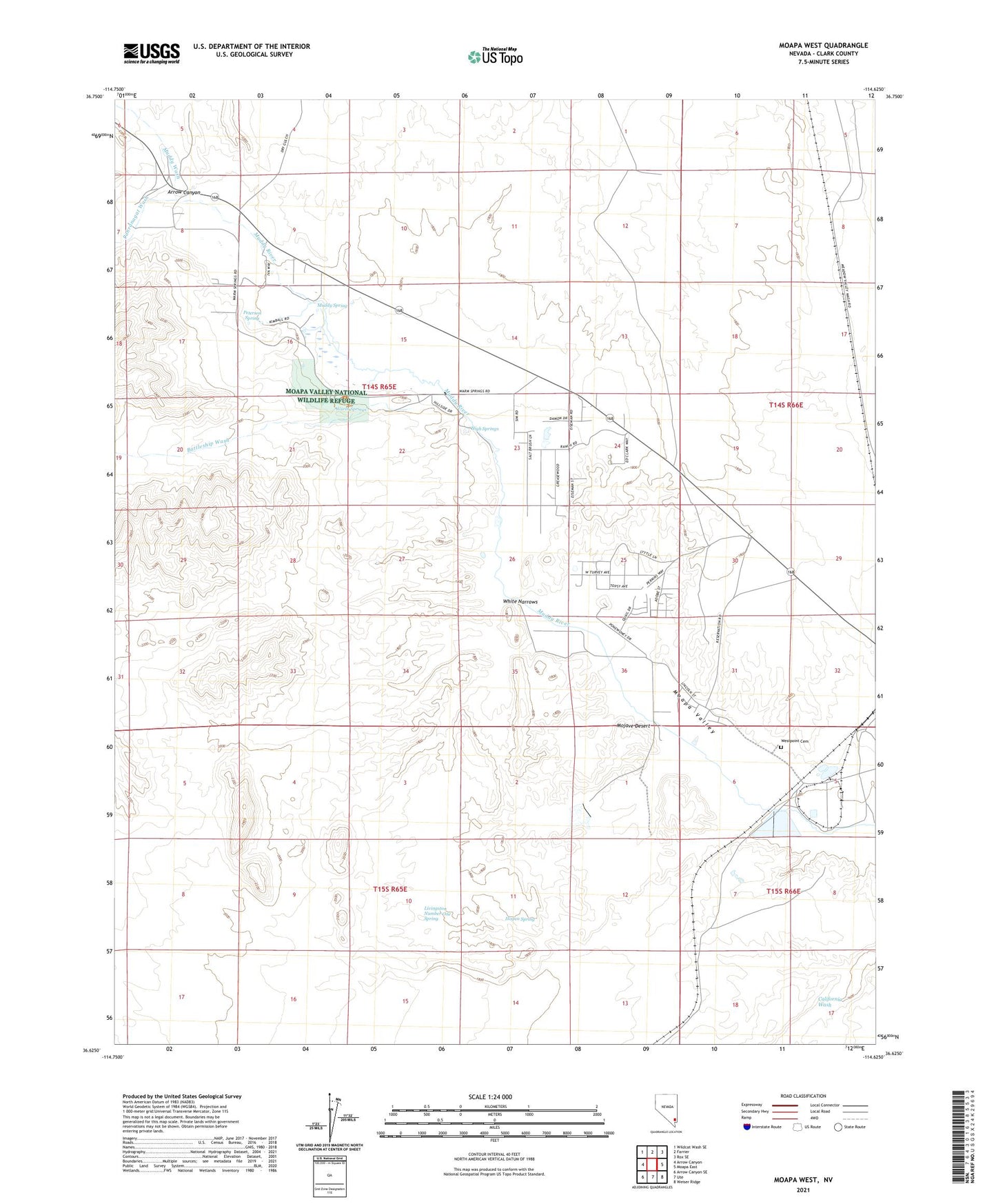
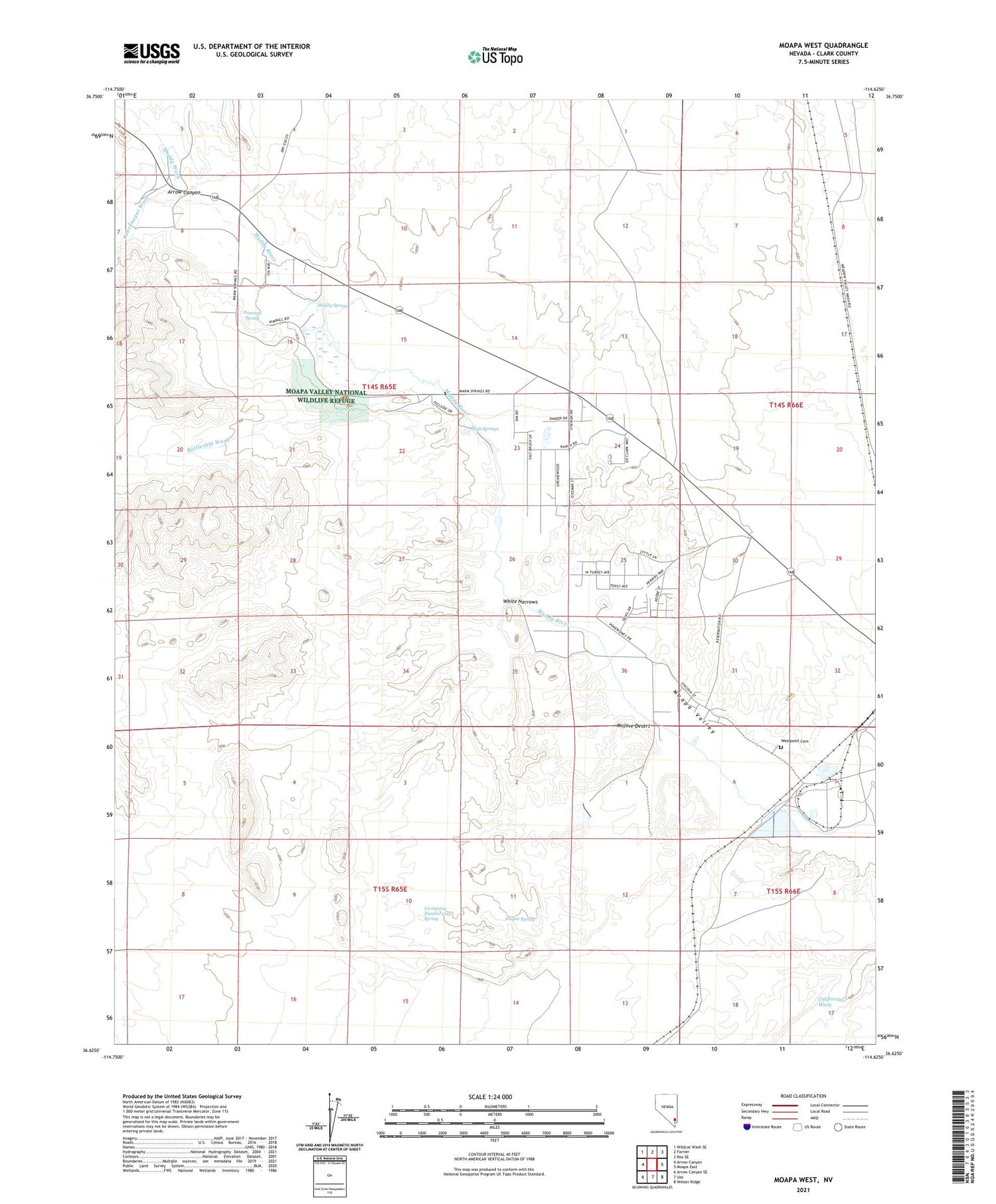
2021 topographic map quadrangle Moapa West in the state of Nevada. Scale: 1:24000. Based on the newly updated USGS 7.5' US Topo map series, this map is in the following counties: Clark. The map contains contour data, water features, and other items you are used to seeing on USGS maps, but also has updated roads and other features. This is the next generation of topographic maps. Printed on high-quality waterproof paper with UV fade-resistant inks.
Quads adjacent to this one:
West: Arrow Canyon
Northwest: Wildcat Wash SE
North: Farrier
Northeast: Rox SE
East: Moapa East
Southeast: Weiser Ridge
South: Ute
Southwest: Arrow Canyon SE
Contains the following named places: Acton, Arrow Canyon, Battleship Wash, CCC Camp, Clarence Lewis Well, Godfrey Ranch, High Springs, Hogan Spring, Home Ranch, Irene Benn Medical Center, Livingston Number One Spring, Moapa Town Census Designated Place, Moapa Valley National Wildlife Refuge, Muddy River, Muddy Spring, Muddy Wash, Pahranagat Wash, Peterson Spring, Warm Springs, West Point, West Point Post Office, Westpoint Cemetery, White Narrows, Woodruff and Perkins Well