MyTopo
Moorman Spring SE Nevada US Topo Map
Couldn't load pickup availability
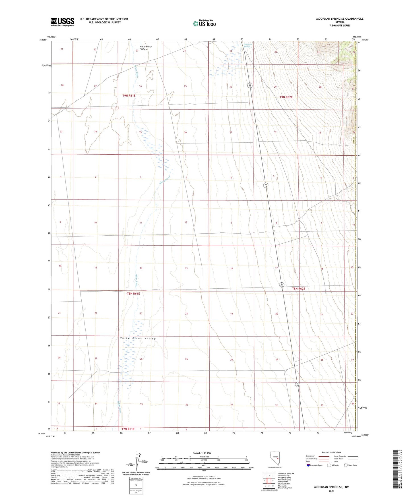
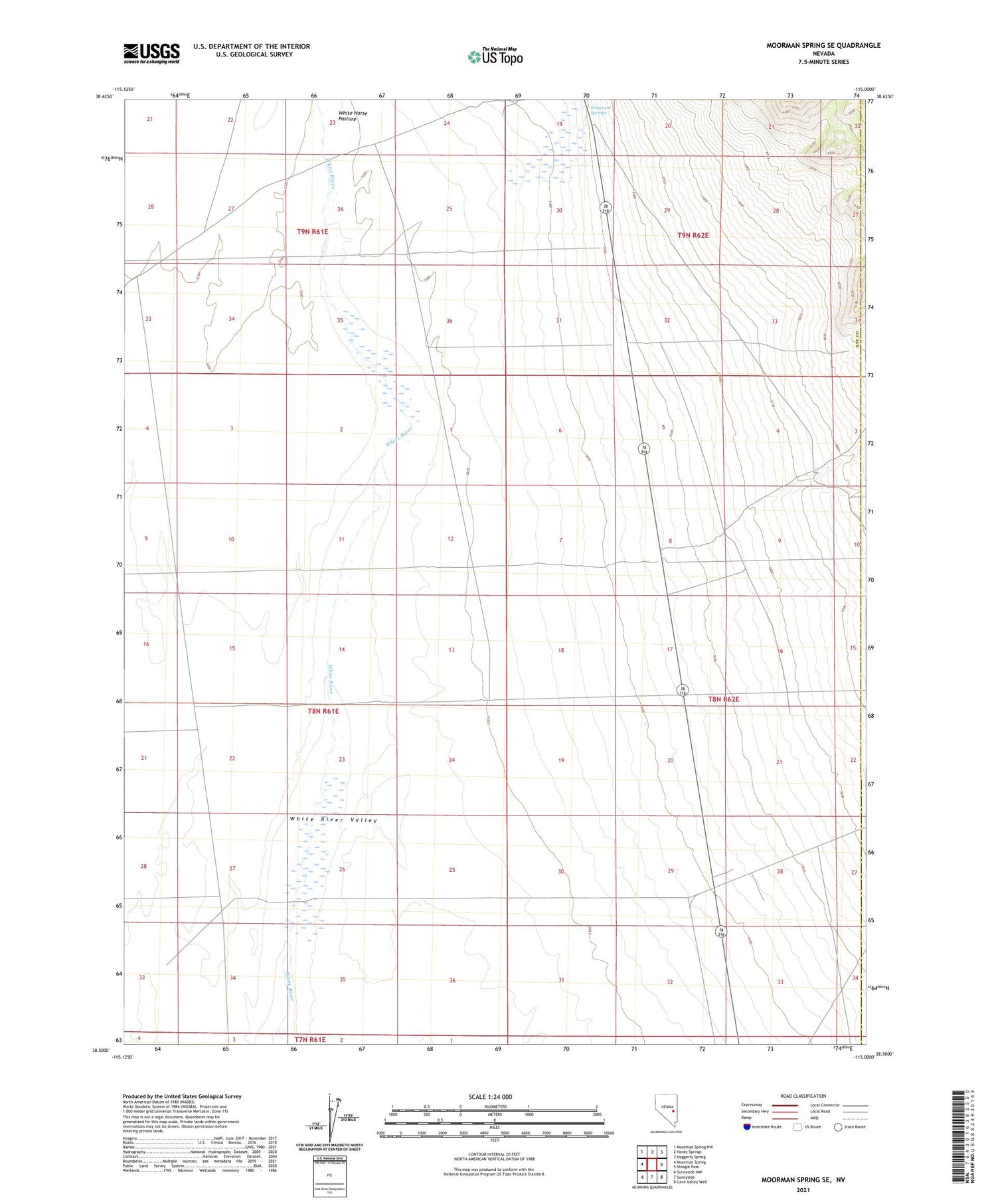
2021 topographic map quadrangle Moorman Spring SE in the state of Nevada. Scale: 1:24000. Based on the newly updated USGS 7.5' US Topo map series, this map is in the following counties: Nye, Lincoln. The map contains contour data, water features, and other items you are used to seeing on USGS maps, but also has updated roads and other features. This is the next generation of topographic maps. Printed on high-quality waterproof paper with UV fade-resistant inks.
Quads adjacent to this one:
West: Moorman Spring
Northwest: Moorman Spring NW
North: Hardy Springs
Northeast: Haggerty Spring
East: Shingle Pass
Southeast: Cave Valley Well
South: Sunnyside
Southwest: Sunnyside NW
Contains the following named places: Carter Ranch, Emigrant Springs, Riorden, White Horse Pasture