MyTopo
Saulsbury Basin Nevada US Topo Map
Couldn't load pickup availability
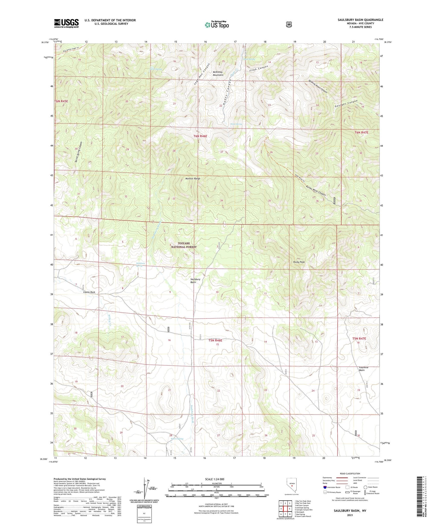
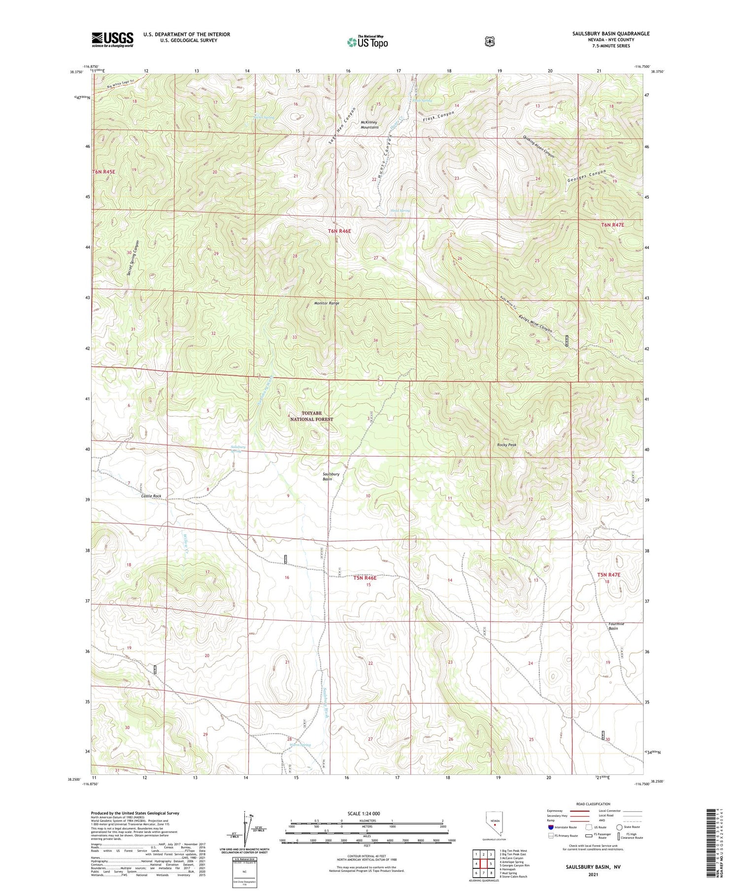
2021 topographic map quadrangle Saulsbury Basin in the state of Nevada. Scale: 1:24000. Based on the newly updated USGS 7.5' US Topo map series, this map is in the following counties: Nye. The map contains contour data, water features, and other items you are used to seeing on USGS maps, but also has updated roads and other features. This is the next generation of topographic maps. Printed on high-quality waterproof paper with UV fade-resistant inks.
Quads adjacent to this one:
West: Antelope Spring
Northwest: Big Ten Peak West
North: Big Ten Peak East
Northeast: McCann Canyon
East: Georges Canyon Rim
Southeast: Stone Cabin Ranch
South: Mud Spring
Southwest: Hannapah
Contains the following named places: Castle Rock, Clipper Mine, Flask Canyon, Flask Spring, Head Spring, Kellys Mine, Little Joe Mine, Quaking Aspen Canyon, Rocky Peak, Salisbury Spring, Saulsbury Basin, Secret Spring, Secret Spring Canyon, Warm Spring