MyTopo
Tenmile Well Nevada US Topo Map
Couldn't load pickup availability
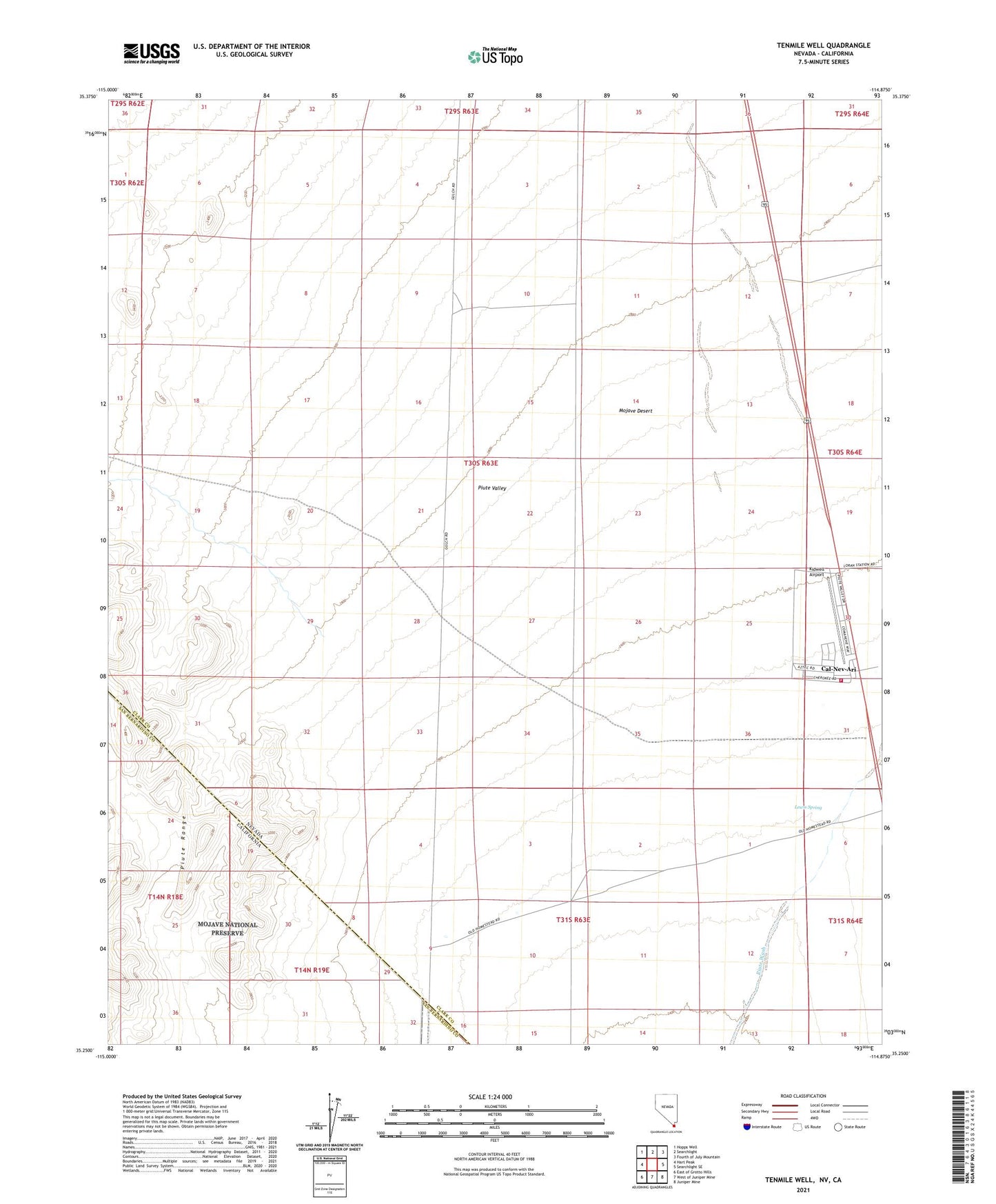
2021 topographic map quadrangle Tenmile Well in the state of Nevada. Scale: 1:24000. Based on the newly updated USGS 7.5' US Topo map series, this map is in the following counties: Clark, San Bernardino. The map contains contour data, water features, and other items you are used to seeing on USGS maps, but also has updated roads and other features. This is the next generation of topographic maps. Printed on high-quality waterproof paper with UV fade-resistant inks.
Quads adjacent to this one:
West: Hart Peak
Northwest: Hopps Well
North: Searchlight
Northeast: Fourth of July Mountain
East: Searchlight SE
Southeast: Juniper Mine
South: West of Juniper Mine
Southwest: East of Grotto Hills
Contains the following named places: Cal Nev Ari Rural Branch Post Office, Cal-Nev-Ari, Cal-Nev-Ari Census Designated Place, Clark County Fire Department Station 84, Kidwell Airport, Lewis Spring, Tenmile Well, Weikel Reservoir, ZIP Code: 89039