MyTopo
Keswick Grove New Jersey US Topo Map
Couldn't load pickup availability
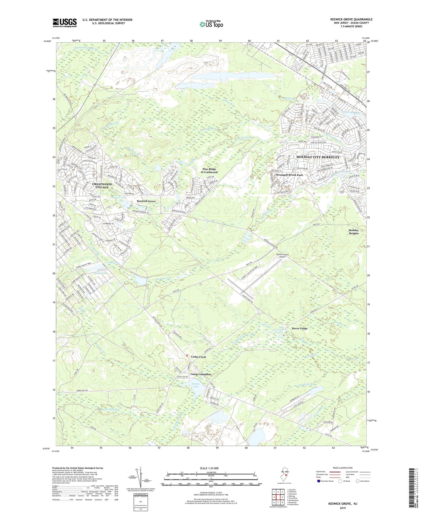
2019 topographic map quadrangle Keswick Grove in the state of New Jersey. Scale: 1:24000. Based on the newly updated USGS 7.5' US Topo map series, this map is in the following counties: Ocean. The map contains contour data, water features, and other items you are used to seeing on USGS maps, but also has updated roads and other features. This is the next generation of topographic maps. Printed on high-quality waterproof paper with UV fade-resistant inks.
Quads adjacent to this one:
West: Whiting
Northwest: Cassville
North: Lakehurst
Northeast: Lakewood
East: Toms River
Southeast: Forked River
South: Brookville
Southwest: Woodmansie
Contains the following named places: Bamber Lake, Bamber Lake Dam, Bamber Lakes Fire Department, Camp Columbus, Cedar Crest, Cedar Swamp, Chamberlain Branch, Crestwood Village, Crestwood Village Census Designated Place, Crossley, Daniels Branch, Davenport, Dover Cranberry Bog, Dover Forge, Green Branch, Harry Wrights Lake, Hilltop Nursery and Kindergarten School, Holiday City At Berkeley First Aid Squad, Holiday City-Berkeley Census Designated Place, Holiday Heights, Holiday Heights Census Designated Place, Keswick Grove, Keswick Lake, Michaels Branch, Newbolds Branch, Ocean County Airport, Pine Ridge at Crestwood, Pine Ridge at Crestwood Census Designated Place, Silver Ridge Park First Aid Squad, Toms River Industrial Park, Township of Manchester, Upper Kesick Dam, Webbs Mill Branch, Whiting Volunteer First Aid Squad, Whiting Wildlife Management Area, William Raws Building, William Raws Monument, WNJO-AM (Toms River), Wrangel Brook Dam, Wrangell Brook Park, Wrights Dam, ZIP Codes: 08757, 08759