
MyTopo
Newton East New Jersey US Topo Map
Couldn't load pickup availability
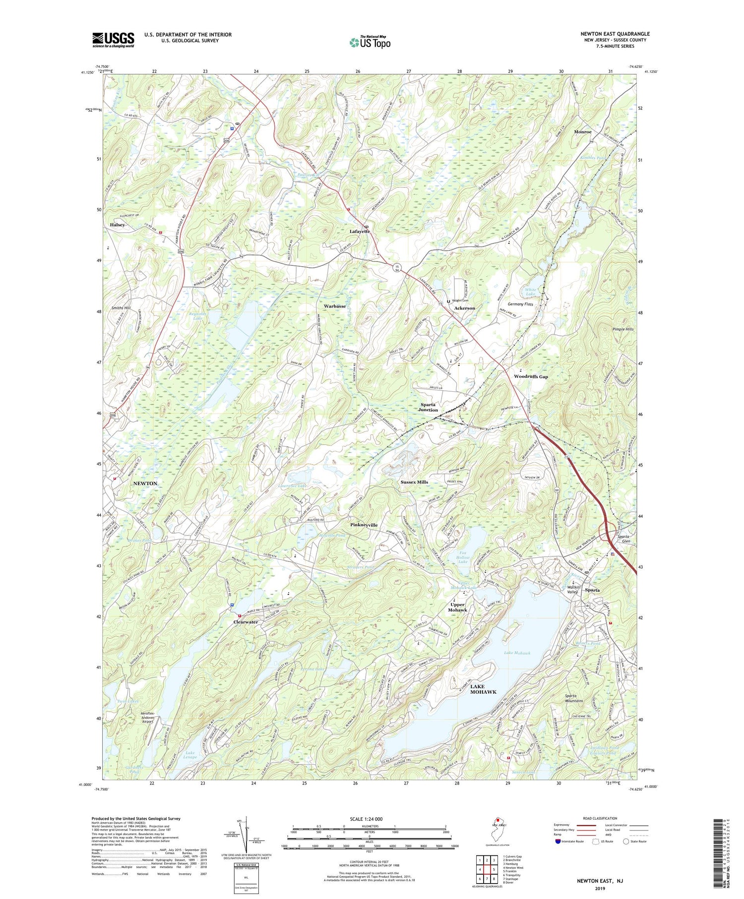
2019 topographic map quadrangle Newton East in the state of New Jersey. Scale: 1:24000. Based on the newly updated USGS 7.5' US Topo map series, this map is in the following counties: Sussex. The map contains contour data, water features, and other items you are used to seeing on USGS maps, but also has updated roads and other features. This is the next generation of topographic maps. Printed on high-quality waterproof paper with UV fade-resistant inks.
Quads adjacent to this one:
West: Newton West
Northwest: Culvers Gap
North: Branchville
Northeast: Hamburg
East: Franklin
Southeast: Dover
South: Stanhope
Southwest: Tranquility
Contains the following named places: Ackerson, Aeroflex-Andover Airport, Andover Township Fire Department, Andover Township Police Department, Arc Ambulance Service, Augusta Gardens Greenhouse, Augusta Post Office, Beisers Pond, Branchville Junction, Clearwater, Clearwater Lake, Drakes Pond, Emilio Perona Dam, Farmstead Golf and Country Club, First Church of Christ Scientist, First Presbyterian Church, Florence M Burd Elementary School, Fowlers Pond, Fox Hollow Dam, Fox Hollow Lake, Gardners Pond, Gardners Pond Dam, Germany Flats, Halsey, Hampton Township Volunteer Fire Department, Helen Morgan Elementary School, Houses Corner, Howells Pond, Hyper-Humas Station, Ideal Farms, Kimbles Pond, Lafayette, Lafayette Post Office, Lafayette Township Fire Department, Lafayette Volunteer Emergency Squad, Laidlaws Pond, Lake Grinnell, Lake Grinnell Dam, Lake Iliff, Lake Lenape, Lake Lenape Dam, Lake Mohawk, Lake Mohawk Census Designated Place, Lake Mohawk Dam, Lake Mohawk Golf Club, Lake Mohawk Golf Course, Lake Saginaw Dam, Lake Shore Farm, Lawrence Dam, Lawrence Lake, Limecrest Quarry, Long Pond School, Mohawk Avenue Elementary School, Monroe, Mulford Station, New Jersey State Police Troop B Sussex Station, New Wawayanda Lake, New Wawayanda Lake Dam, Newton Country Club, Newton Fire Patrol Station, Newton Fire Prevention Office, Newton Pit, Newton Playground, Newton Police Department, Our Lady of the Lake Church, Perona Lake, Pimple Hills, Pinkneyville, Pope John XXIII High School, Reverend George A Brown School, Reynolds Lake, Reynolds Lake Dam, Rolling Greens Golf Club, Ross Corner, Ross Corner Census Designated Place, Seneca Lake, Smiths Hill, Sparta, Sparta Alpine Elementary School, Sparta Glen, Sparta Junction, Sparta Post Office, Sparta Station, Sparta Township Fire Department, Sparta Township Police Department, Sparta Volunteer Ambulance Service, Straders Pond, Sussex County Technical Vocational School, Sussex Mills, Township of Andover, Township of Lafayette, Township of Sparta, Twin Lakes, Ungerman Field, Upper Lake Mohawk, Upper Mohawk, Upper Mohawk Lake, Upper Mohawk Lake Dam, Vaughn Cemetery, Veritas Christian Academy, Warbasse, Wawayanda, White Lake, White Lake Farm, WNNJ-AM (Newton), WNNJ-FM (Newton), Woodruffs Gap, ZIP Codes: 07848, 07871


