MyTopo
Seven Lakes NE New Mexico US Topo Map
Couldn't load pickup availability
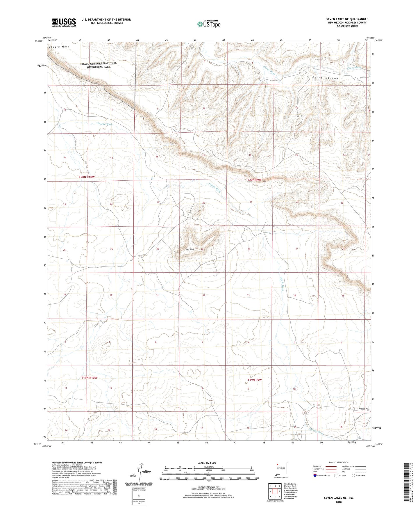
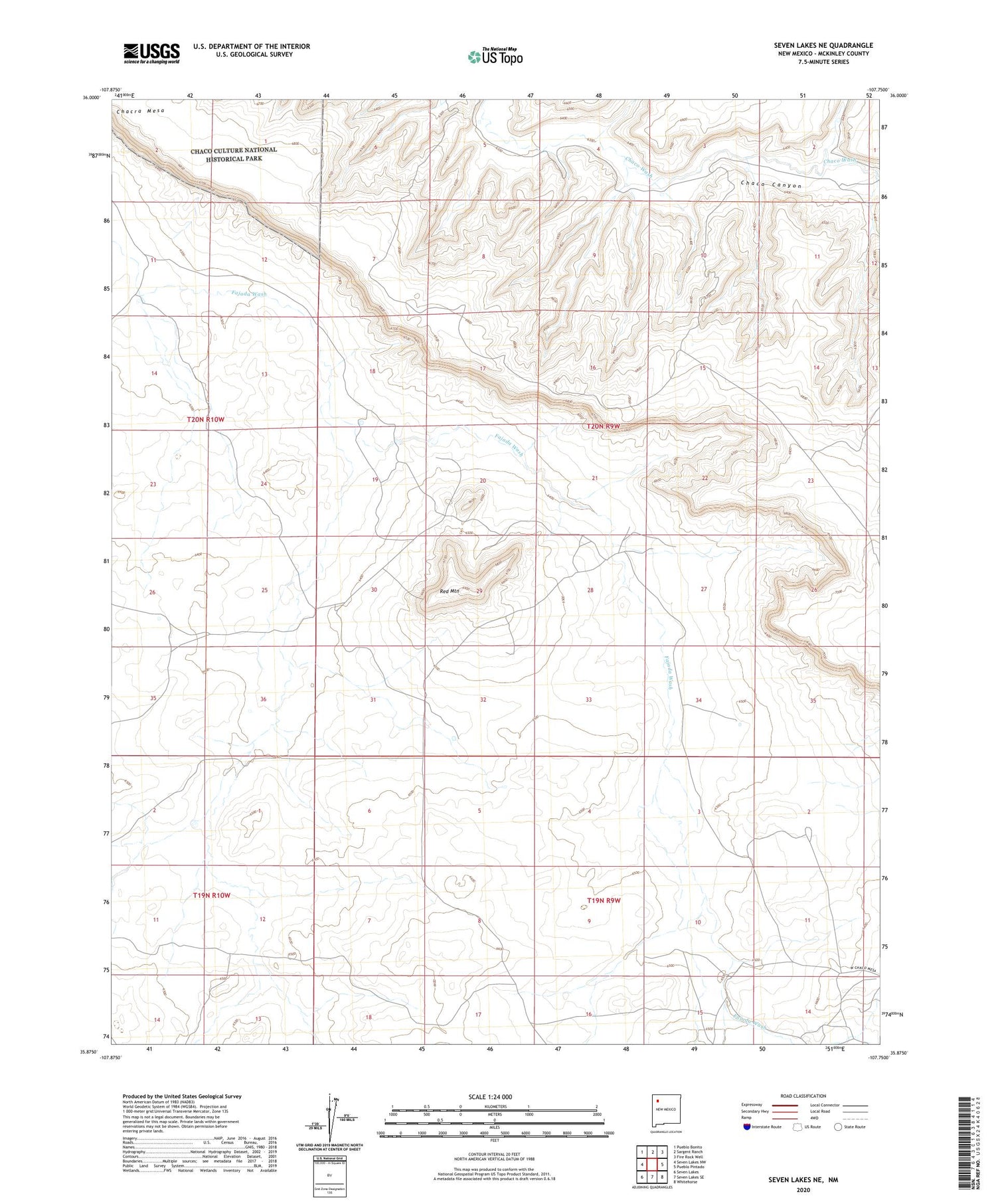
2020 topographic map quadrangle Seven Lakes NE in the state of New Mexico. Scale: 1:24000. Based on the newly updated USGS 7.5' US Topo map series, this map is in the following counties: McKinley. The map contains contour data, water features, and other items you are used to seeing on USGS maps, but also has updated roads and other features. This is the next generation of topographic maps. Printed on high-quality waterproof paper with UV fade-resistant inks.
Quads adjacent to this one:
West: Seven Lakes NW
Northwest: Pueblo Bonito
North: Sargent Ranch
Northeast: Fire Rock Well
East: Pueblo Pintado
Southeast: Whitehorse
South: Seven Lakes SE
Southwest: Seven Lakes
Contains the following named places: CCR 13 Water Well, CCR 17 Water Well, CCR 18 Water Well, CCR-5 Water Well, CCR-8 Water Well, Red Mountain, Red Mountain Oil Field