MyTopo
Vaughn New Mexico US Topo Map
Couldn't load pickup availability
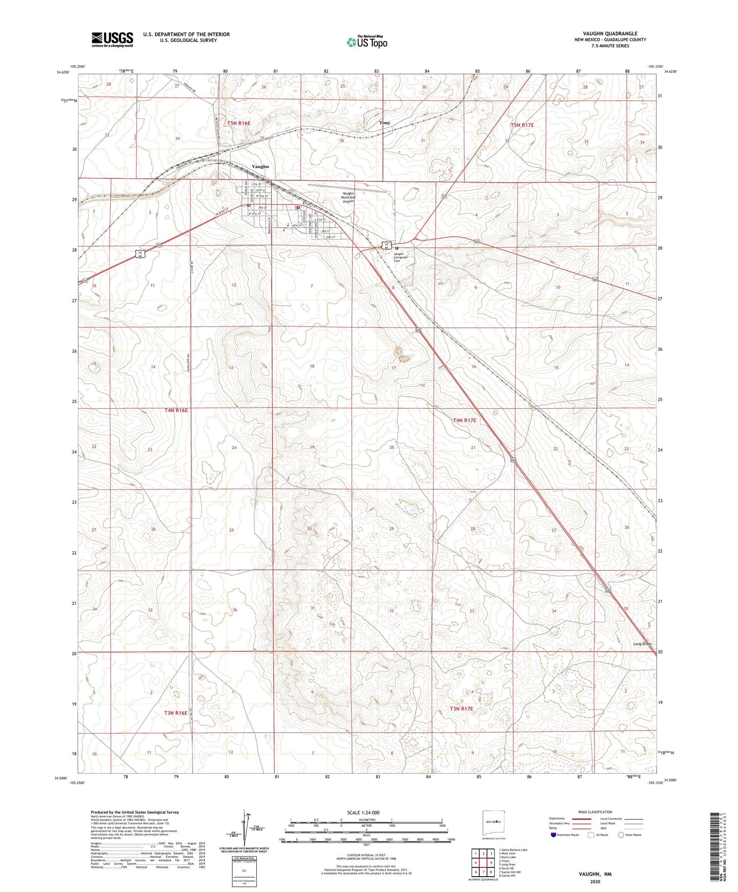
2020 topographic map quadrangle Vaughn in the state of New Mexico. Scale: 1:24000. Based on the newly updated USGS 7.5' US Topo map series, this map is in the following counties: Guadalupe. The map contains contour data, water features, and other items you are used to seeing on USGS maps, but also has updated roads and other features. This is the next generation of topographic maps. Printed on high-quality waterproof paper with UV fade-resistant inks.
Quads adjacent to this one:
West: Tejon
Northwest: Santa Barbara Lake
North: Mesa Leon
Northeast: Burro Lake
East: Long Draw
Southeast: Gacho Hill
South: Gacho Hill NW
Southwest: Duran NE
Contains the following named places: First Baptist Church, Huntsinger Park, Tony, Town of Vaughn, Vaughn, Vaughn Ambulance Service, Vaughn Elementary School, Vaughn Evergreen Cemetery, Vaughn High School, Vaughn Historical Marker, Vaughn Municipal Airport, Vaughn Police Department, Vaughn Post Office, Vaughn Volunteer Fire Department, Vaughn Weather Station