MyTopo
Whitewater Mountains New Mexico US Topo Map
Couldn't load pickup availability
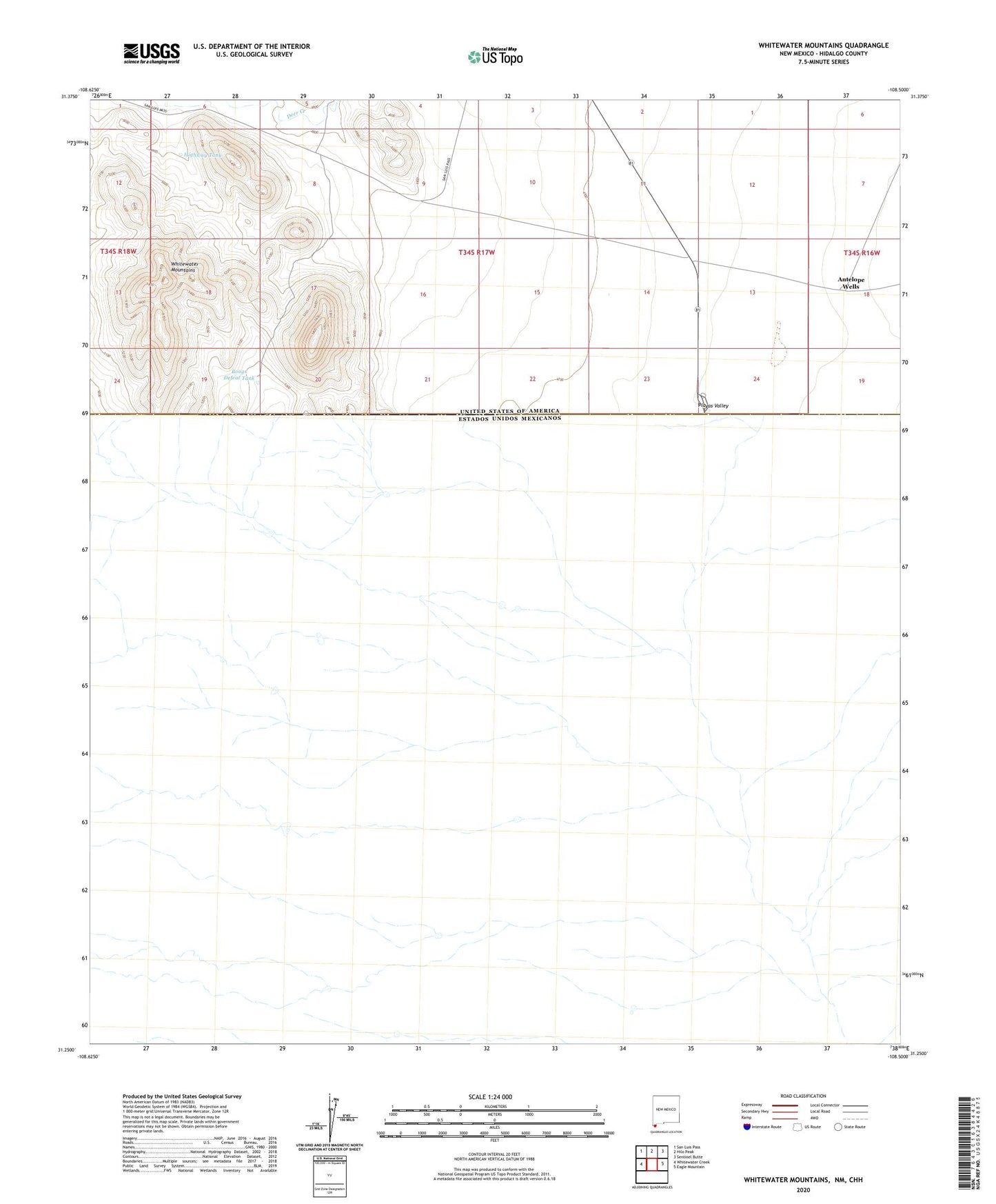
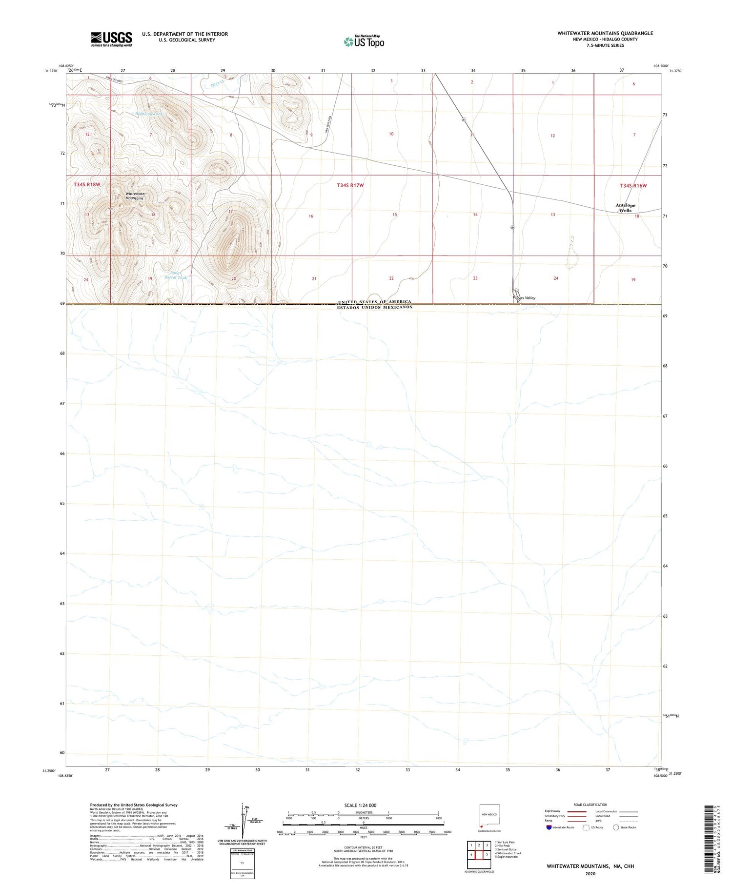
2020 topographic map quadrangle Whitewater Mountains in the state of New Mexico. Scale: 1:24000. Based on the newly updated USGS 7.5' US Topo map series, this map is in the following counties: Hidalgo. The map contains contour data, water features, and other items you are used to seeing on USGS maps, but also has updated roads and other features. This is the next generation of topographic maps. Printed on high-quality waterproof paper with UV fade-resistant inks.
Quads adjacent to this one:
West: Whitewater Creek
Northwest: San Luis Pass
North: Hilo Peak
Northeast: Sentinel Butte
East: Eagle Mountain
Contains the following named places: Antelope Wells, Boogs Defeat Tank, Culberson Historic Site, Highway Tank, Playas Valley, Whitewater Mountains