MyTopo
Fort Niagara New York US Topo Map
Couldn't load pickup availability
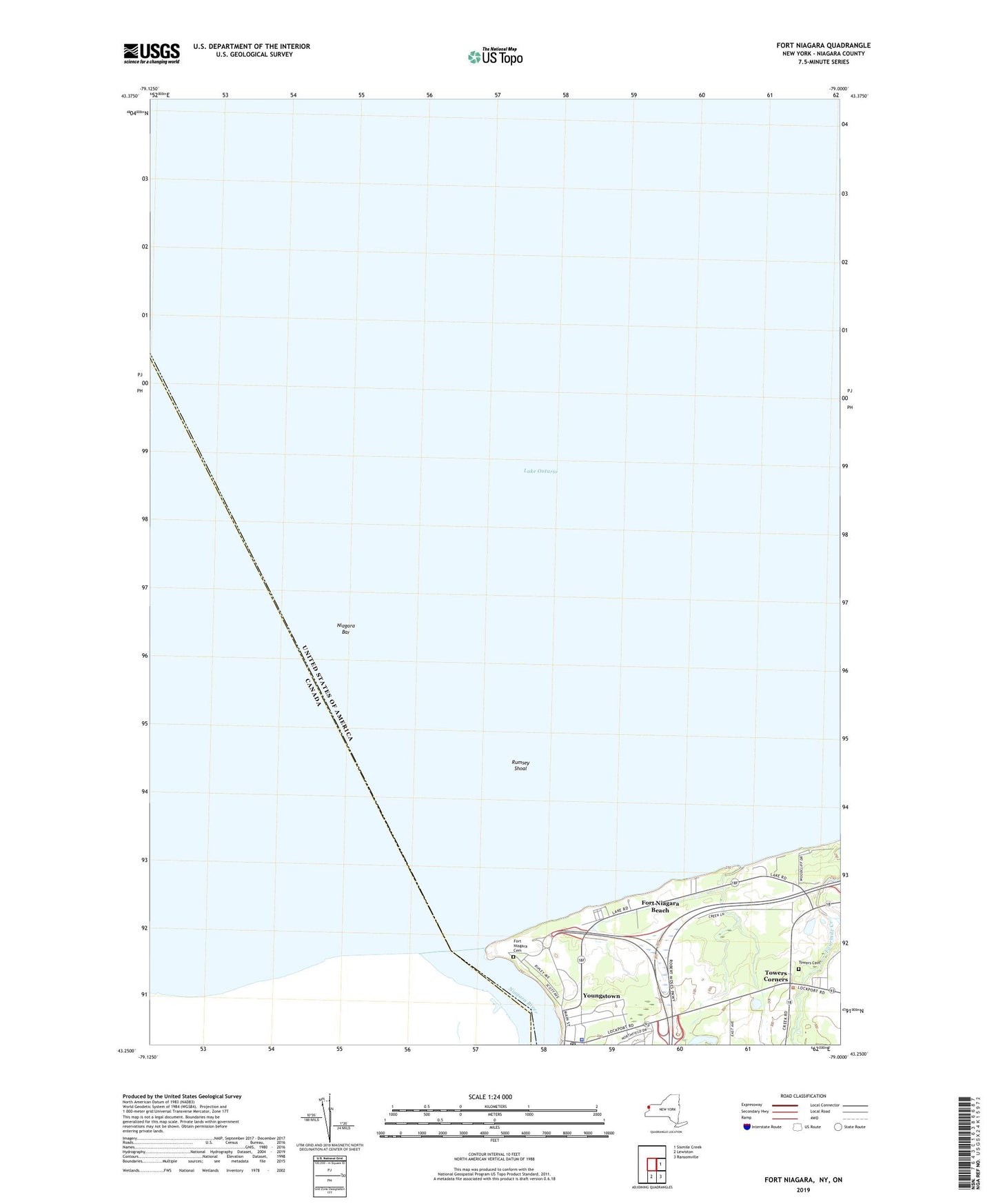
2019 topographic map quadrangle Fort Niagara in the state of New York. Scale: 1:24000. Based on the newly updated USGS 7.5' US Topo map series, this map is in the following counties: Niagara. The map contains contour data, water features, and other items you are used to seeing on USGS maps, but also has updated roads and other features. This is the next generation of topographic maps. Printed on high-quality waterproof paper with UV fade-resistant inks.
Quads adjacent to this one:
East: Sixmile Creek
Southeast: Ransomville
South: Lewiston
Contains the following named places: Falkner Park, Fort Niagara, Fort Niagara Beach, Fort Niagara Cemetery, Fort Niagara Post Cemetery, Fort Niagara State Park, Niagara Bar, Niagara Fan, Niagara River, Porter Town Hall, Rumsey Shoal, Saint John's Episcopal Church, Sanger Farms, Shippy Orchards, Towers Cemetery, Towers Corners, Youngstown Free Library, Youngstown Post Office, Youngstown Yacht Club