MyTopo
McGraw New York US Topo Map
Couldn't load pickup availability
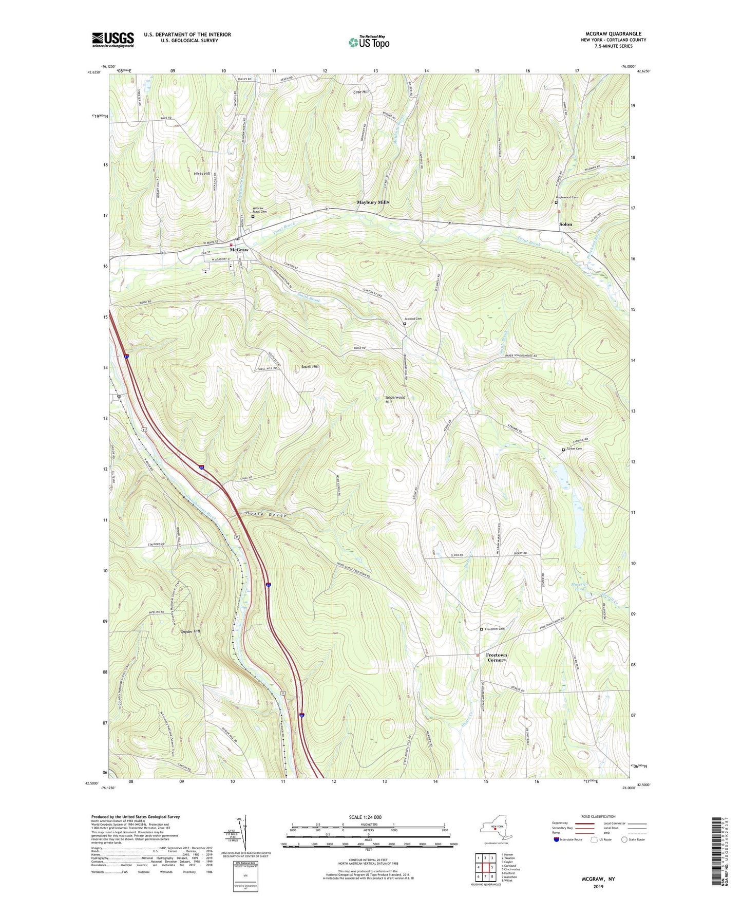
2019 topographic map quadrangle McGraw in the state of New York. Scale: 1:24000. Based on the newly updated USGS 7.5' US Topo map series, this map is in the following counties: Cortland. The map contains contour data, water features, and other items you are used to seeing on USGS maps, but also has updated roads and other features. This is the next generation of topographic maps. Printed on high-quality waterproof paper with UV fade-resistant inks.
Quads adjacent to this one:
West: Cortland
Northwest: Homer
North: Truxton
Northeast: Cuyler
East: Cincinnatus
Southeast: Willet
South: Marathon
Southwest: Harford
Contains the following named places: Atwood Cemetery, Baker School, Blodgett Mills Post Office, Carr Hill School, Case Hill, Church At Freetown, Cortland County, Freetown Cemetery, Freetown Corners, Hicks Hill, Hoxie Gorge, Hoxie Gorge School, LaMont Memorial Free Library, Maplewood Cemetery, Maybury Brook, Maybury Mills, McGraw, McGraw Elementary School, McGraw Fire Department, McGraw High School, McGraw Post Office, McGraw Rural Cemetery, McGraw United Methodist Church, McGrawville Baptist Church, Moscript Pond, Mosquito Creek, Old Stone School, Pine Hollow Farm, Pritchard Brook, Russell School, School Number 11, School Number 4, School Number 5, School Number 6, Seven Valley Christian Church, Shearer School, Smith Brook, Snyder Hill, Solon, South Hill, Syrian School, Town of Cortlandville, Town of Freetown, Town of Solon, Turner Cemetery, Underwood Hill, Village of McGraw, White Schoolhouse, ZIP Code: 13101