MyTopo
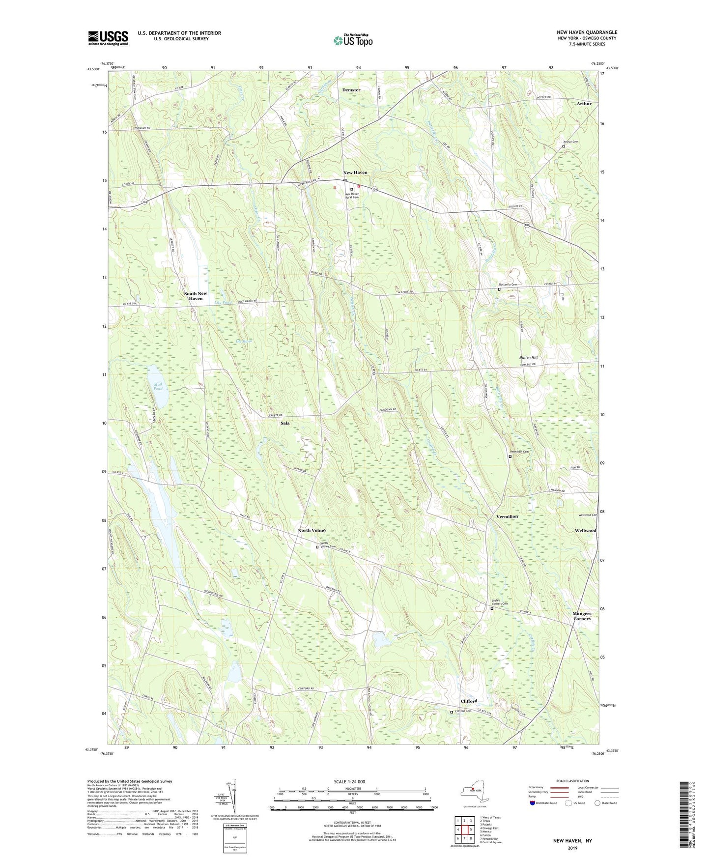
New Haven New York US Topo Map
Couldn't load pickup availability
2019 topographic map quadrangle New Haven in the state of New York. Scale: 1:24000. Based on the newly updated USGS 7.5' US Topo map series, this map is in the following counties: Oswego. The map contains contour data, water features, and other items you are used to seeing on USGS maps, but also has updated roads and other features. This is the next generation of topographic maps. Printed on high-quality waterproof paper with UV fade-resistant inks.
Quads adjacent to this one:
West: Oswego East
Northwest: West of Texas
North: Texas
Northeast: Pulaski
East: Mexico
Southeast: Central Square
South: Pennellville
Southwest: Fulton
Contains the following named places: Arthur Cemetery, Austins Corners, Behling Orchards, Butterfly Cemetery, Butterfly Corners, Clifford, Clifford Cemetery, Community Alliance Church, Cribbs Corner, Cummings Bridge, Demster, Demster Grove Camp Ground, Drakes Corner, First Congregational Church, Jacobson Farms, Johnson Corners, Lily Marsh, Lily Pond, Maple Help Stock Farms, Mud Pond, Mullen Hill, Mungers Corners, New Haven, New Haven Elementary School, New Haven Post Office, New Haven Rural Cemetery, New Haven Station, New Haven United Methodist Church, New Haven Volunteer Fire Department, North Volney, North Volney Cemetery, Pleasant Point Crossing, Sala, Sayles Corners, Sayles Corners Cemetery, School Number 1, School Number 10, School Number 11, School Number 2, School Number 3, School Number 5, School Number 6, School Number 7, School Number 9, South New Haven, Town of New Haven, Vermilion, Vermilion Cemetery, Wellwood