MyTopo
North Wolcott New York US Topo Map
Couldn't load pickup availability
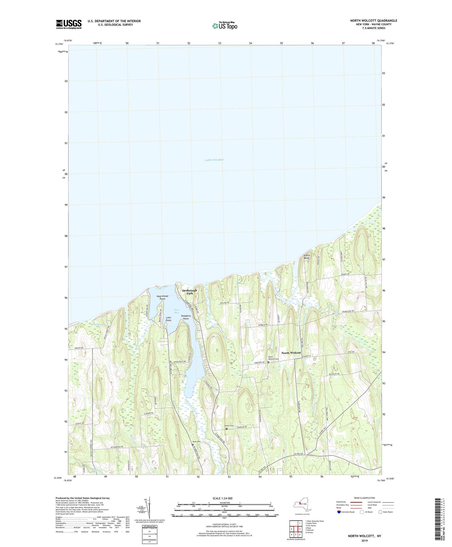
2019 topographic map quadrangle North Wolcott in the state of New York. Scale: 1:24000. Based on the newly updated USGS 7.5' US Topo map series, this map is in the following counties: Wayne. The map contains contour data, water features, and other items you are used to seeing on USGS maps, but also has updated roads and other features. This is the next generation of topographic maps. Printed on high-quality waterproof paper with UV fade-resistant inks.
Quads adjacent to this one:
West: Sodus Point
Northeast: West Ninemile Point
East: Fair Haven
Southeast: Victory
South: Wolcott
Southwest: Rose
Contains the following named places: Beaver Creek, Black Creek, Brush Marsh, Desbrough Park, Haywoods Fruit Farm, Joiner Cemetery, Little Creek, Loon Point, Negrohead Point, North Wolcott, North Wolcott Cemetery, North Wolcott Christian Church, Park Cemetery, Port Bay, Port Bay Golf Club, Port Bay Recreational Vehicle Park and Campground, Red Creek, School Number 12, School Number 13, School Number 2, School Number 4, School Number 7, School Number 8, Scotts Bluff, Tompkins Point, Town of Wolcott, Wolcott Creek