MyTopo
Pike New York US Topo Map
Couldn't load pickup availability
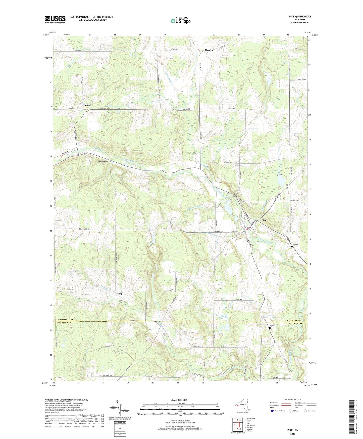
2019 topographic map quadrangle Pike in the state of New York. Scale: 1:24000. Based on the newly updated USGS 7.5' US Topo map series, this map is in the following counties: Wyoming, Allegany. The map contains contour data, water features, and other items you are used to seeing on USGS maps, but also has updated roads and other features. This is the next generation of topographic maps. Printed on high-quality waterproof paper with UV fade-resistant inks.
Quads adjacent to this one:
West: Bliss
Northwest: Johnsonburg
North: Warsaw
Northeast: Castile
East: Portageville
Southeast: Fillmore
South: Houghton
Southwest: Freedom
Contains the following named places: Alger Cemetery, Bush Brook, Camp Sam Wood, Dole Cemetery, Eagle Center, Elm Creek, Emory Brook, Griffith Corners, Hardys, Howes, Lyonsburg Cemetery, Monument Circle Historic District, Neal Family Farm, Pike, Pike Cemetery, Pike Census Designated Place, Pike Community Church, Pike Five Corners, Pike Post Office, Pike Volunteer Fire Department, Rolling Acres Golf Course, Rolling Acres Golf Course and Campground, Spring Brook, Town of Eagle, Town of Pike, Trout Brook, Village of Pike, Wing, Wiscoy Farms, ZIP Codes: 14024, 14130