MyTopo
Readburn New York US Topo Map
Couldn't load pickup availability
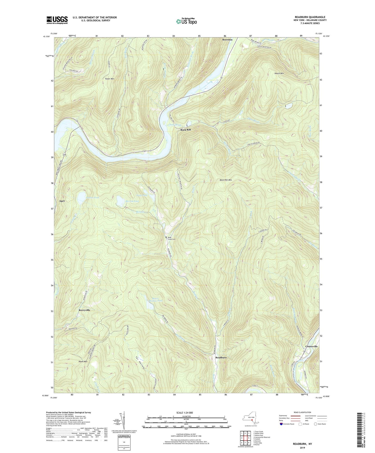
2019 topographic map quadrangle Readburn in the state of New York. Scale: 1:24000. Based on the newly updated USGS 7.5' US Topo map series, this map is in the following counties: Delaware. The map contains contour data, water features, and other items you are used to seeing on USGS maps, but also has updated roads and other features. This is the next generation of topographic maps. Printed on high-quality waterproof paper with UV fade-resistant inks.
Quads adjacent to this one:
West: Cannonsville Reservoir
Northwest: Trout Creek
North: Walton West
Northeast: Walton East
East: Corbett
Southeast: Horton
South: Fishs Eddy
Southwest: Hancock
Contains the following named places: Apex, Beaver Meadow Pond, Centerville, Chase Brook, Community Full Gospel Church, Dry Brook, East Brook, Fish Brook, Houck Mountain, Johnnie Brook, Kerryville, Merrick Pond, Morrison Brook, Perkins Pond, Pines Lookout Tower, Read Creek Cemetery, Readburn, Rich Creek, Rock Rift, Rock Rift Mountain, Spencer Brook, Tower Mountain, Trask Pond, Wakeman Brook