MyTopo
Wilson New York US Topo Map
Couldn't load pickup availability
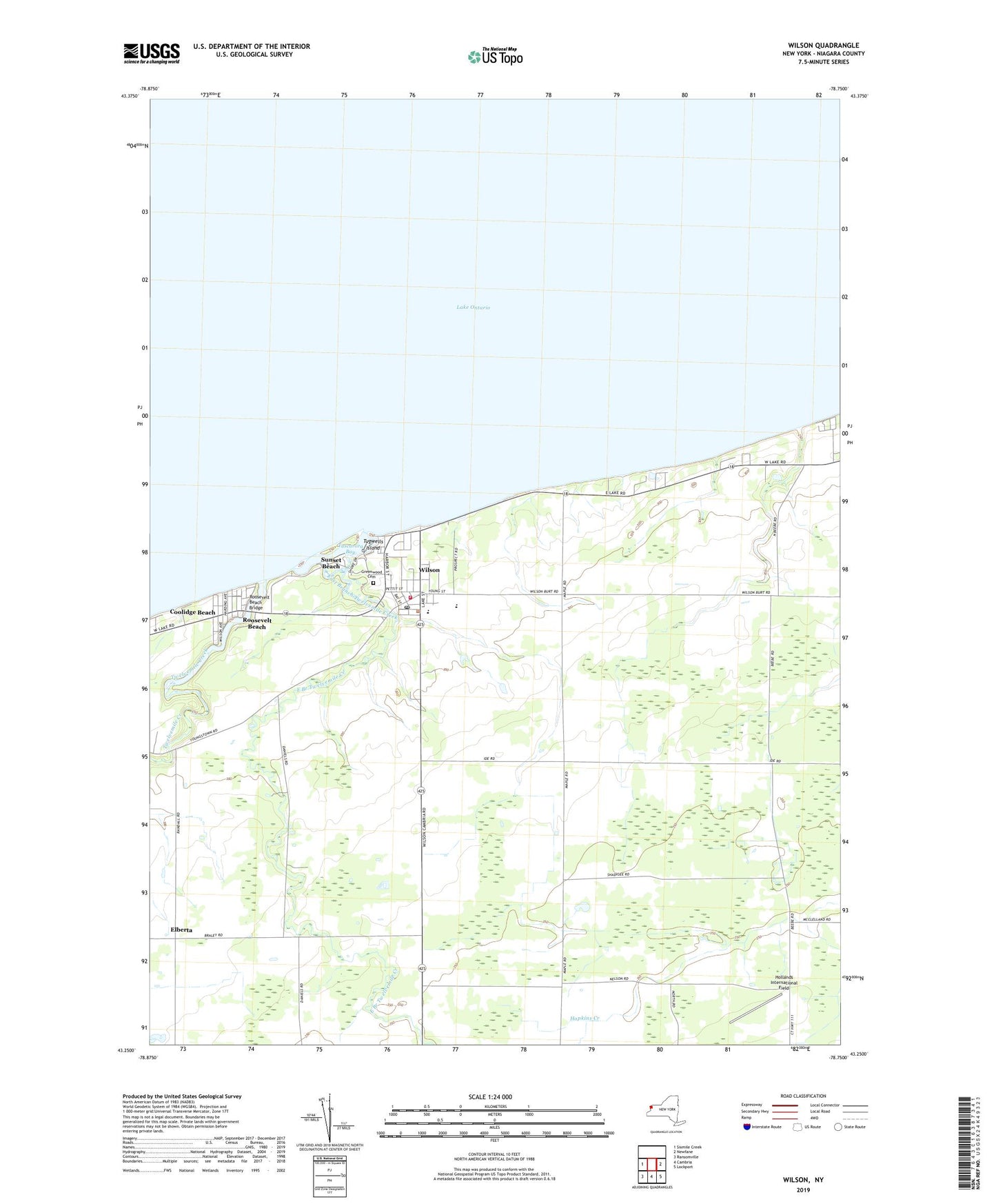
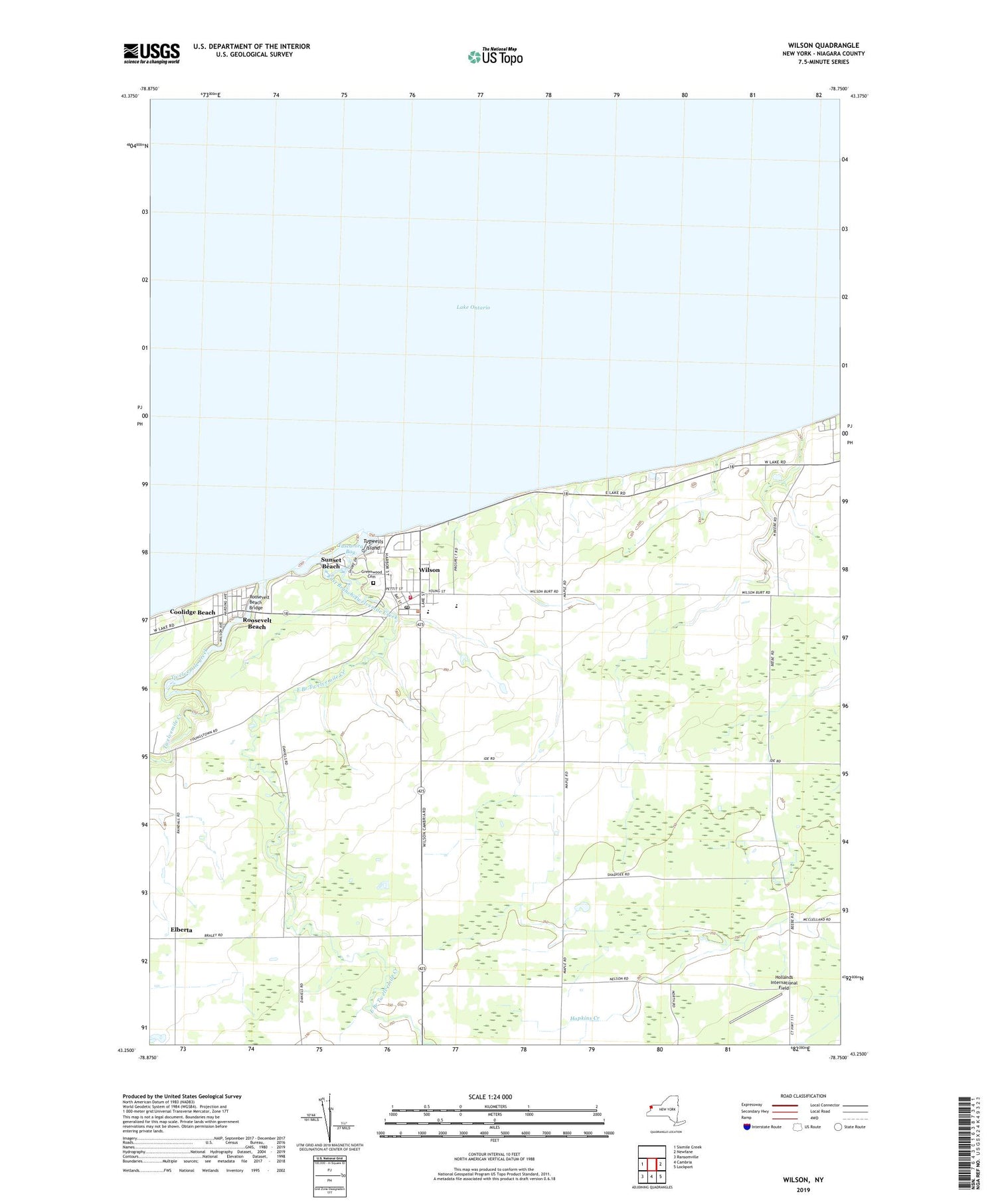
2019 topographic map quadrangle Wilson in the state of New York. Scale: 1:24000. Based on the newly updated USGS 7.5' US Topo map series, this map is in the following counties: Niagara. The map contains contour data, water features, and other items you are used to seeing on USGS maps, but also has updated roads and other features. This is the next generation of topographic maps. Printed on high-quality waterproof paper with UV fade-resistant inks.
Quads adjacent to this one:
West: Sixmile Creek
East: Newfane
Southeast: Lockport
South: Cambria
Southwest: Ransomville
Contains the following named places: Beccue Boat Basin, Clark Marina, Concordia Church, Coolidge Beach, Daisy Barn Campground, East Branch Twelvemile Creek, Elberta, Exley United Methodist Church, First Baptist Church of Wilson, Greenwood Cemetery, Hollands International Field, Niagara County, North Wilson, Our Lady of the Rosary Roman Catholic Church, Pierhead Light 2, Pleasant Corners, Roosevelt Beach, Roosevelt Beach Bridge, Saint John's Episcopal Church, Saint Paul's Evangelical Lutheran Church, School Number 12, School Number 13, School Number 2, School Number 5, School Number 8, Sunset Beach, Thomas Marks Elementary School, Town of Wilson, Tugwells Island, Tuscarora Bay, Tuscarora Park, Tuscarora Yacht Club, Twelvemile Creek, Village of Wilson, Village of Wilson Water Works, Wilson, Wilson Free Library, Wilson High School, Wilson Post Office, Wilson Town Hall, Wilson Union School, Wilson Volunteer Fire Company 1, Wilson Yacht Club, ZIP Code: 14172