
MyTopo
Camden Point North Carolina US Topo Map
Couldn't load pickup availability
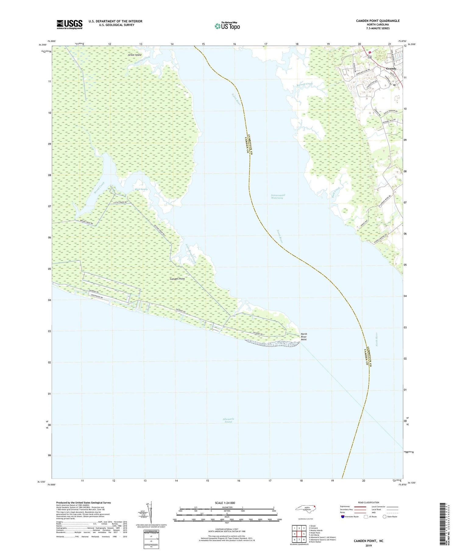
2019 topographic map quadrangle Camden Point in the state of North Carolina. Scale: 1:24000. Based on the newly updated USGS 7.5' US Topo map series, this map is in the following counties: Camden, Currituck. The map contains contour data, water features, and other items you are used to seeing on USGS maps, but also has updated roads and other features. This is the next generation of topographic maps. Printed on high-quality waterproof paper with UV fade-resistant inks.
Quads adjacent to this one:
West: Wade Point
Northwest: Shiloh
North: Coinjock
Northeast: Mossey Islands
East: Jarvisburg
Southeast: Point Harbor
Contains the following named places: Barnett Creek, Barnett Creek Landing, Broad Creek, Camden Point, Cathedral of the Cross, Currituck County Fire / EMS - Station 5 Lower Currituck, Duck Creek, Grandy, Grandy Census Designated Place, Grandy Post Office, Great Island, Hunting Creek, Little Broad Creek, Lower Currituck Fire Department - Station 5, Lutz Creek, Mount Zion Church, North River, North River Point, Walnut Island, ZIP Codes: 27947, 27974


