MyTopo
Coinjock North Carolina US Topo Map
Couldn't load pickup availability
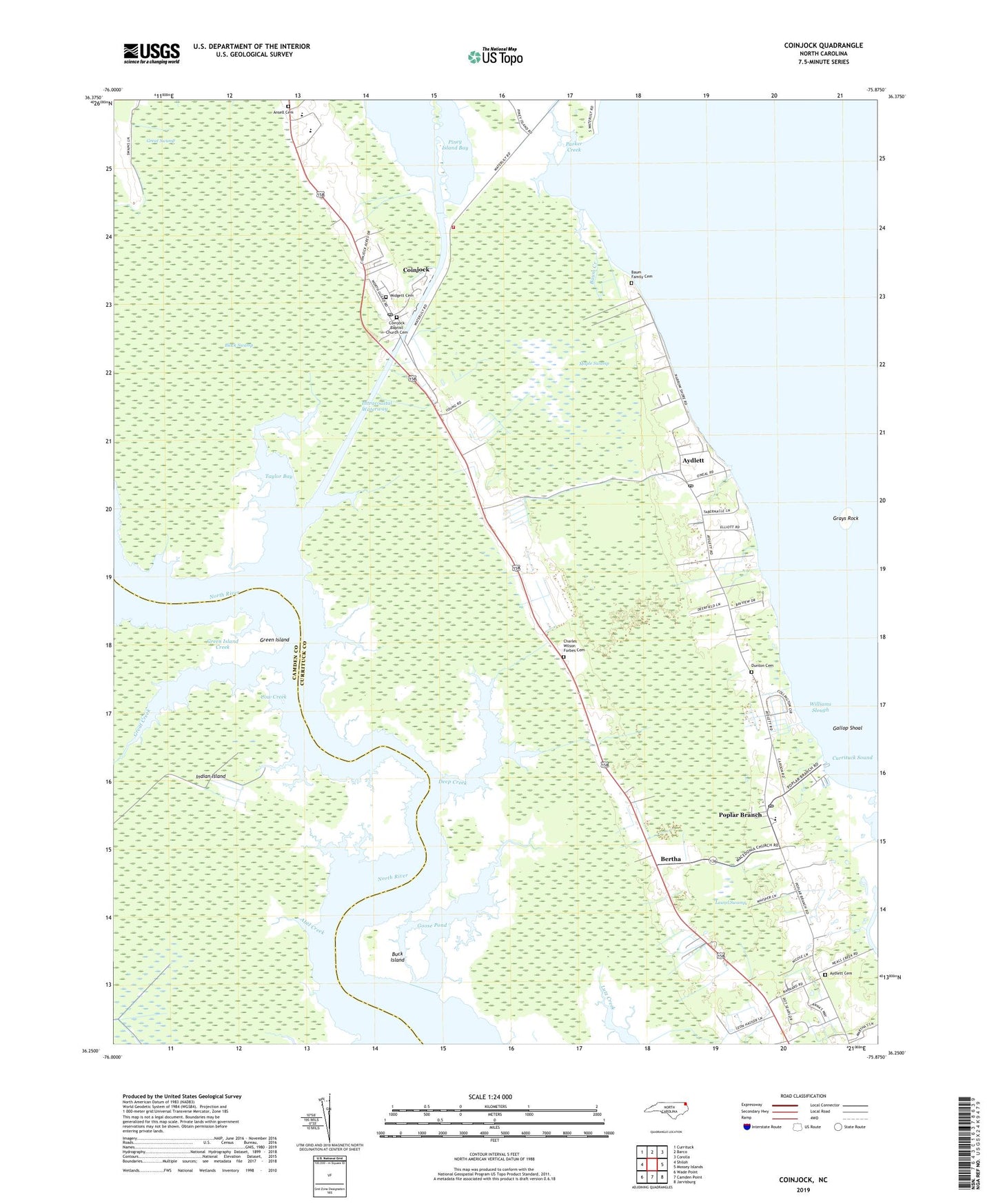
2019 topographic map quadrangle Coinjock in the state of North Carolina. Scale: 1:24000. Based on the newly updated USGS 7.5' US Topo map series, this map is in the following counties: Currituck, Camden. The map contains contour data, water features, and other items you are used to seeing on USGS maps, but also has updated roads and other features. This is the next generation of topographic maps. Printed on high-quality waterproof paper with UV fade-resistant inks.
Quads adjacent to this one:
West: Shiloh
Northwest: Currituck
North: Barco
Northeast: Corolla
East: Mossey Islands
Southeast: Jarvisburg
South: Camden Point
Southwest: Wade Point
Contains the following named places: Abel Creek, Ansell Cemetery, Aydlett, Aydlett Cemetery, Aydlett Post Office, Backlanding Creek, Baum Creek, Baum Family Cemetery, Bertha, Buck Island, Bumplanding Creek, Center Chapel, Charles Wilson Forbes Cemetery, Coinjock, Coinjock Baptist Church Cemetery, Coinjock Census Designated Place, Coinjock Post Office, Cow Creek, Currituck County, Currituck County Fire and Emergency Medical Services Station 2, Currituck County High School, Currituck County Library - Main Branch, Deep Creek, Doctor W T Griggs Elementary School, Dunton Cemetery, Gallop Shoal, Goose Pond, Grays Rock, Great Creek, Great Swamp, Green Island, Green Island Creek, Indian Island, Laurel Swamp, Long Creek, Lower Currituck Volunteer Fire Department Waterlily Station, Maple Swamp, Midgett Cemetery, Midway Marina, Narrow Ridges, NI-11 Airport, Piney Island Bay, Poplar Branch, Poplar Branch Landing, Poplar Branch Post Office, Public Creek, Sharon Church, Taylor Bay, Williams Slough, ZIP Codes: 27916, 27917, 27965