MyTopo
Hamilton North Carolina US Topo Map
Couldn't load pickup availability
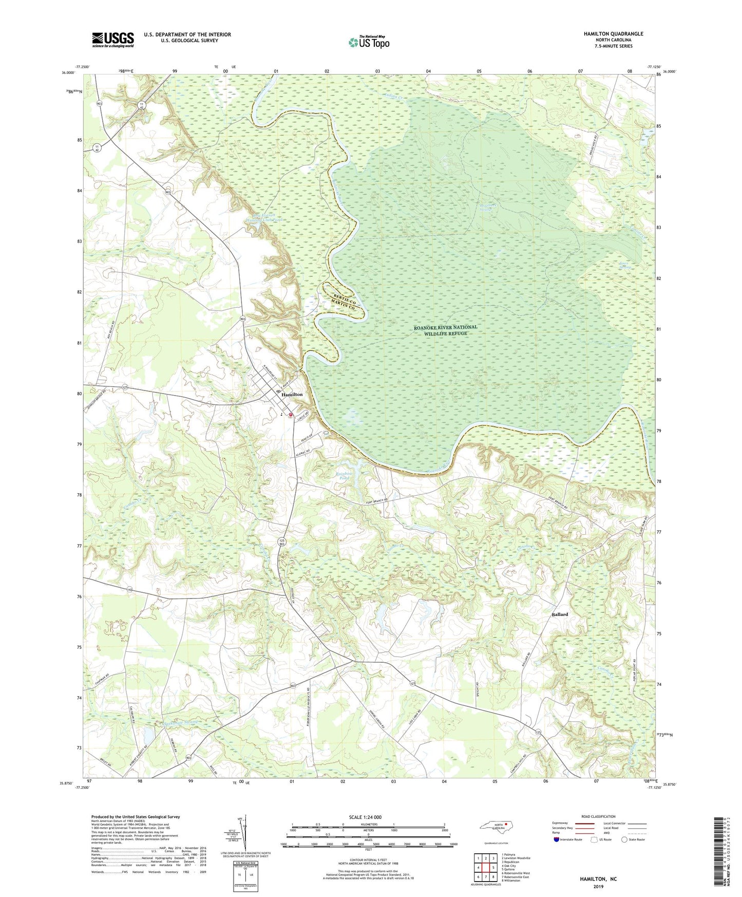
2019 topographic map quadrangle Hamilton in the state of North Carolina. Scale: 1:24000. Based on the newly updated USGS 7.5' US Topo map series, this map is in the following counties: Martin, Bertie. The map contains contour data, water features, and other items you are used to seeing on USGS maps, but also has updated roads and other features. This is the next generation of topographic maps. Printed on high-quality waterproof paper with UV fade-resistant inks.
Quads adjacent to this one:
West: Oak City
Northwest: Palmyra
North: Lewiston Woodville
Northeast: Republican
East: Quitsna
Southeast: Williamston
South: Robersonville East
Southwest: Robersonville West
Contains the following named places: Ballard, Beaverdam Creek, Broadneck Swamp, Cedar Grove Church, Chapel Hill Church, Cocks Landing, Edna Andrews School, Hamilton, Hamilton Post Office, Hamilton Volunteer Fire Department, Indian Creek, Lynch Chapel, Old Fort, Old Landing, Rainbow Banks, Rainbow Pond, Rainbow Pond Dam, Rascoes Mill, Roanoke River National Wildlife Refuge, Roanoke Tabernacle, Roy Everett Hunting Club Pond, Roy Everett Hunting Club Pond Dam, Spring Green Church, Town of Hamilton, Town Swamp, Township of Hamilton, Township of Poplar Point, Zion Grove Church, ZIP Code: 27840