MyTopo
Lewiston Woodville North Carolina US Topo Map
Couldn't load pickup availability
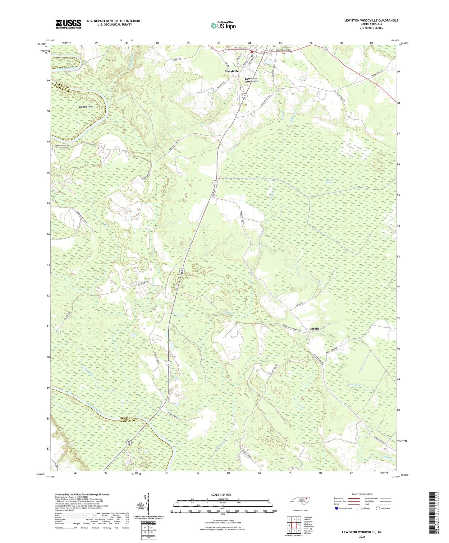
2021 topographic map quadrangle Lewiston Woodville in the state of North Carolina. Scale: 1:24000. Based on the newly updated USGS 7.5' US Topo map series, this map is in the following counties: Bertie, Martin, Halifax. The map contains contour data, water features, and other items you are used to seeing on USGS maps, but also has updated roads and other features. This is the next generation of topographic maps. Printed on high-quality waterproof paper with UV fade-resistant inks.
Quads adjacent to this one:
West: Palmyra
Northwest: Norfleet
North: Kelford
Northeast: Aulander
East: Republican
Southeast: Quitsna
South: Hamilton
Southwest: Oak City
Contains the following named places: Apple Tree Landing, Bond School, Buzzard Point, Cahaba, Canal Gut, Flag Run Gut, Flag Run Landing, Jacks Branch, Lewiston Woodville, Lewiston Woodville Police Department, Lewiston Woodville Post Office, Lewiston Woodville Volunteer Fire Department and Emergency Medical Services, Mount Joy Church, Saint Lukes Church, Spring Hill Church, Town of Lewiston Woodville, Township of Woodville, Village Gate Church, Weeping Mary Church, Woodville, ZIP Code: 27849