MyTopo
McDonald North Carolina US Topo Map
Couldn't load pickup availability
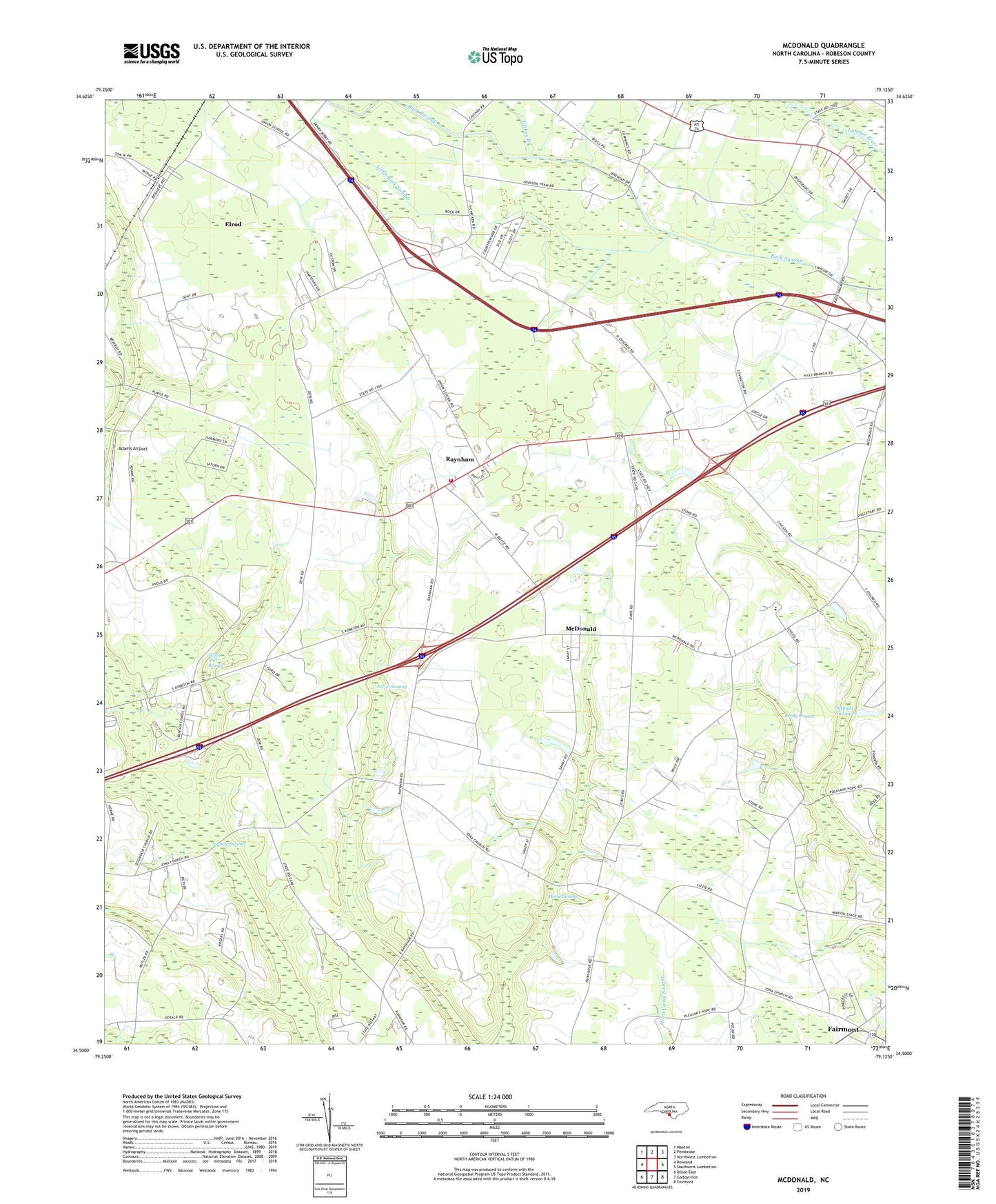
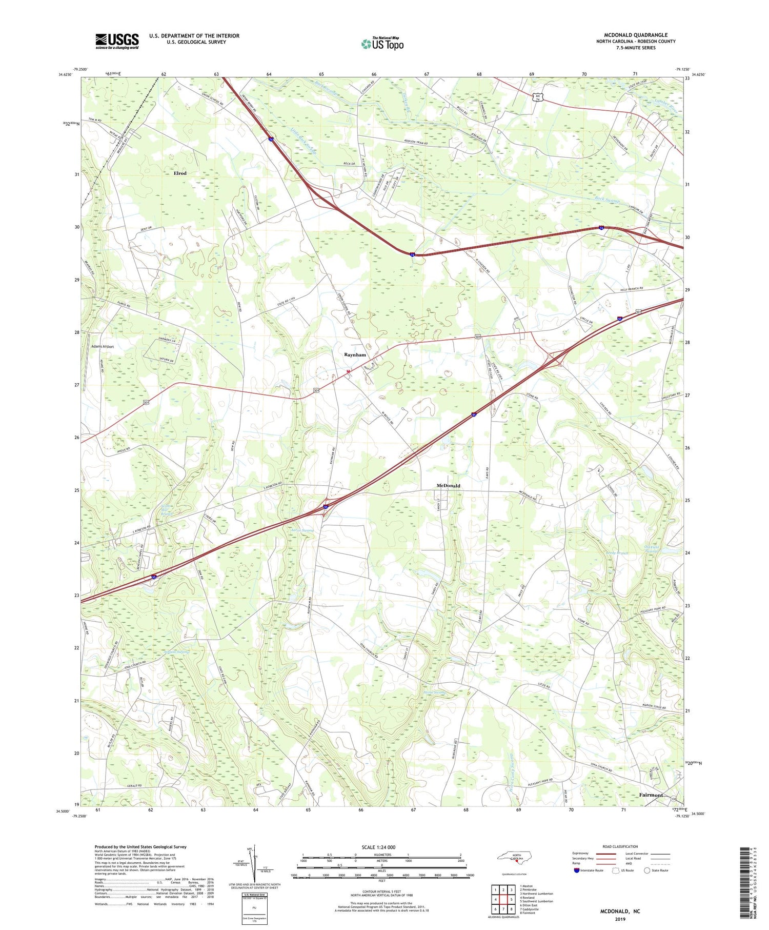
2019 topographic map quadrangle McDonald in the state of North Carolina. Scale: 1:24000. Based on the newly updated USGS 7.5' US Topo map series, this map is in the following counties: Robeson. The map contains contour data, water features, and other items you are used to seeing on USGS maps, but also has updated roads and other features. This is the next generation of topographic maps. Printed on high-quality waterproof paper with UV fade-resistant inks.
Quads adjacent to this one:
West: Rowland
Northwest: Maxton
North: Pembroke
Northeast: Northwest Lumberton
East: Southwest Lumberton
Southeast: Fairmont
South: Gaddysville
Southwest: Dillon East
Contains the following named places: Aaron Church, Aaron Swamp, Adams Airport, Asbury Church, Ashpole Swamp, Back Swamp Church, Benson Church, Dogwood Church, Elrod, Elrod Census Designated Place, Green Grove Elementary School, Horse Swamp, Iona Church, Little Back Swamp, McDonald, New Bethel Church, Pleasant Grove Church, Pleasant Hope Church, Providence Church, Raynham, Raynham - McDonald Volunteer Fire Department, Reedy Branch, Reedy Branch Church, Scotts Mill Branch, Town of McDonald, Town of Raynham, Township of Thompson, Township of Union, Turkey Branch