MyTopo
Mossey Islands North Carolina US Topo Map
Couldn't load pickup availability
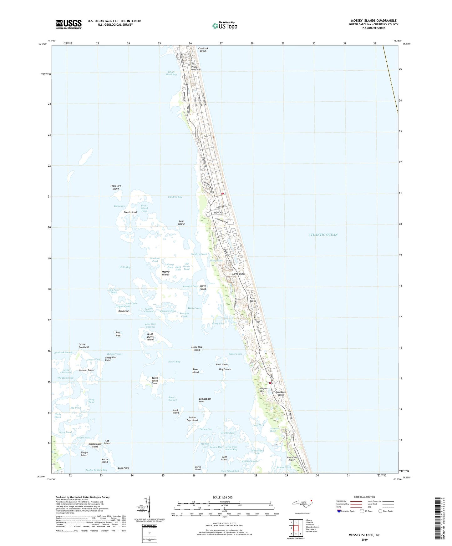
2019 topographic map quadrangle Mossey Islands in the state of North Carolina. Scale: 1:24000. Based on the newly updated USGS 7.5' US Topo map series, this map is in the following counties: Currituck. The map contains contour data, water features, and other items you are used to seeing on USGS maps, but also has updated roads and other features. This is the next generation of topographic maps. Printed on high-quality waterproof paper with UV fade-resistant inks.
Quads adjacent to this one:
West: Coinjock
Northwest: Barco
North: Corolla
Southeast: Martin Point
South: Jarvisburg
Southwest: Camden Point
Contains the following named places: Ballast Bay, Baums Creek, Bay Tree, Bearhead, Beasley Bay, Big Narrows, Big Pond, Brant Island, Brant Island Pond, Burris Bay, Bush Island, Buzzard Lead, Canvasback Point, Canvasback Pond, Cat Island, Cattle Pen Point, Corolla Fire and Rescue - Pine Island Station, Corolla Fire and Rescue - Whalehead Station, Currituck Banks, Currituck County Fire / EMS - Station 6 Corolla, Currituck County Fire / EMS - Station 7 Pine Island, Currituck Light, Currituck Sound, Deep Neck, Dotty Pond, Duck Hole, Fosters Channel, Gaffey Landing, Goat Island, Goat Island Bay, Great Beach Pond, Greys Island, Hog Islands, House Pond, Indian Gap, Indian Gap Island, Jarvis Channel, Little Goat Island Bay, Little Hog Island, Little Narrows, Lone Oak Channel, Long Island, Long Point, Long Point Pond, Long Pond, Mallard Pond, Marsh Island, Monteray Plaza, Mossey Islands, Mossy Pond, Myrtle Bay, Narrows Island, Neals Creek, North Burris Island, Northeast Pond, Old House Pond, Outer Banks Center for Wildlife Education, Overhaul Pond, Perch Pond, Peters Quarter, Pine Island Airport, Pine Island Gun Club Center, Piney Cove, Poplar Branch Bay, Porpoise Pond, Poyner Hill C G Station, Poyners Hill, Rattlesnake Island, Sand Cove, Sanders Bay, Sanders Creek, Sedge Island, Sheep Pen Point, Sledge Island, South Burris Island, Steer Island, Straight Creek, Strait Creek, Stumpy Cove, Swan Island, Tar Cove Marsh, Taylor Creek, The Hammock, Thorofare, Thorofare Island, Three Dunes, Tim Buck II Shopping Center, Township of Poplar Branch, Turkells Gut, Ware Creek, Wells Bay, Wells Creek, Whale Head Bay, Whale Head Hill, Whole Head Bay, ZIP Code: 27927