
MyTopo
Balta North Dakota US Topo Map
Couldn't load pickup availability
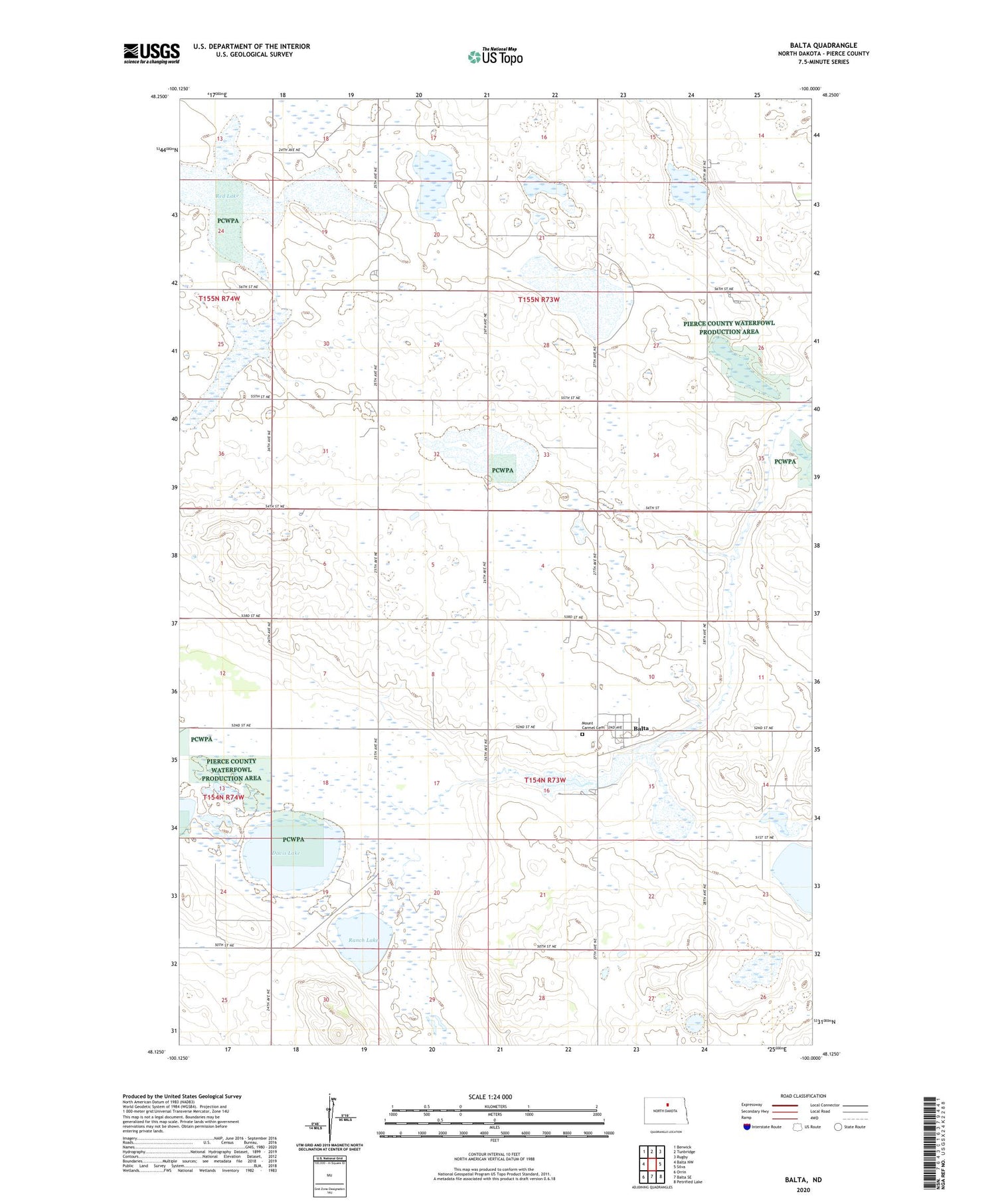
2020 topographic map quadrangle Balta in the state of North Dakota. Scale: 1:24000. Based on the newly updated USGS 7.5' US Topo map series, this map is in the following counties: Pierce. The map contains contour data, water features, and other items you are used to seeing on USGS maps, but also has updated roads and other features. This is the next generation of topographic maps. Printed on high-quality waterproof paper with UV fade-resistant inks.
Quads adjacent to this one:
West: Balta NW
Northwest: Berwick
North: Tunbridge
Northeast: Rugby
East: Silva
Southeast: Petrified Lake
South: Balta SE
Southwest: Orrin
Contains the following named places: Balta, Balta Dam, Brazil School Number 2, Brazil School Number 3, City of Balta, Davis Lake, De Smet County, Mount Carmel Cemetery, Ranch Lake, Red Lake, Township of Balta, Township of Tuscarora


