MyTopo
Bergen North Dakota US Topo Map
Couldn't load pickup availability
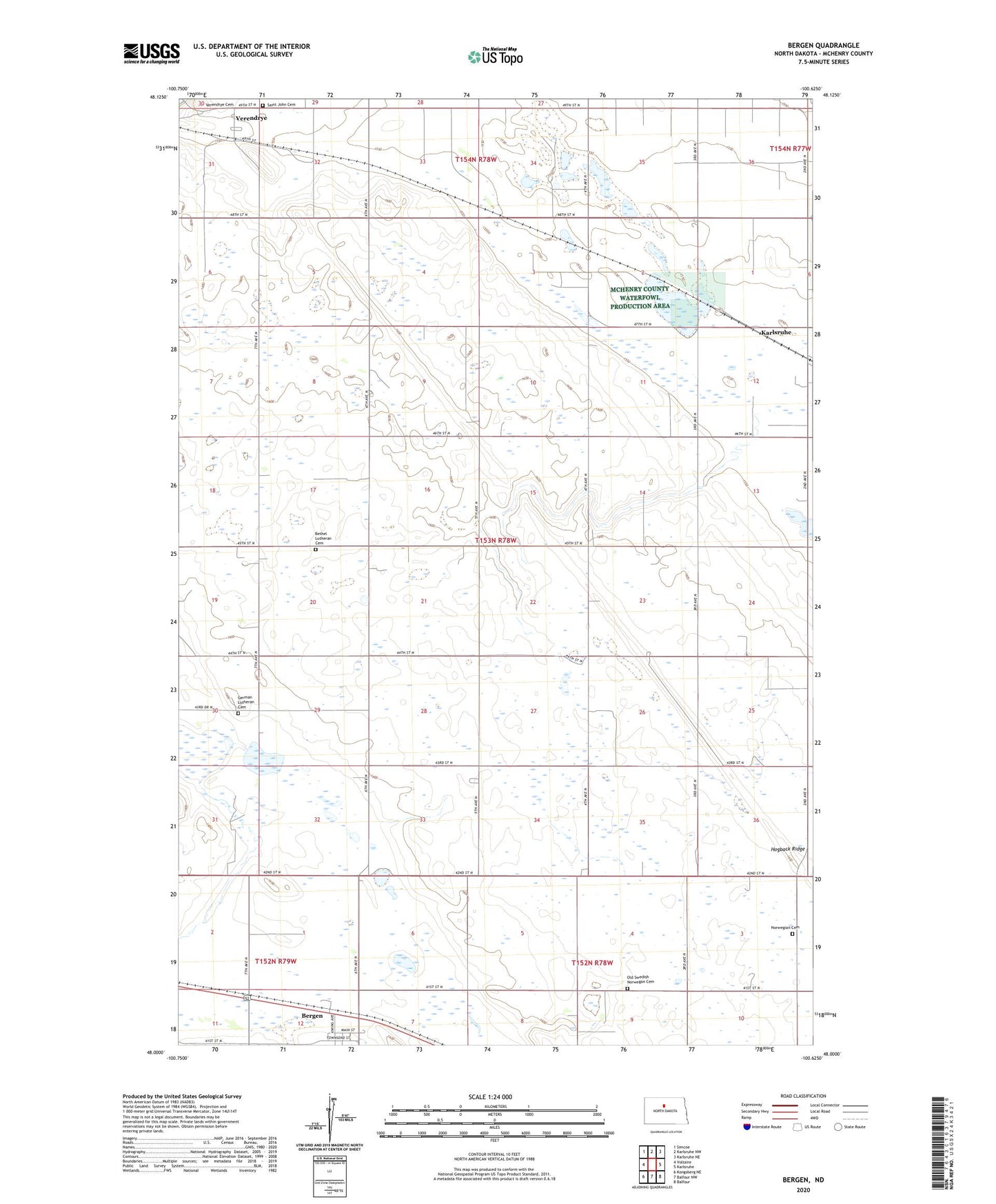
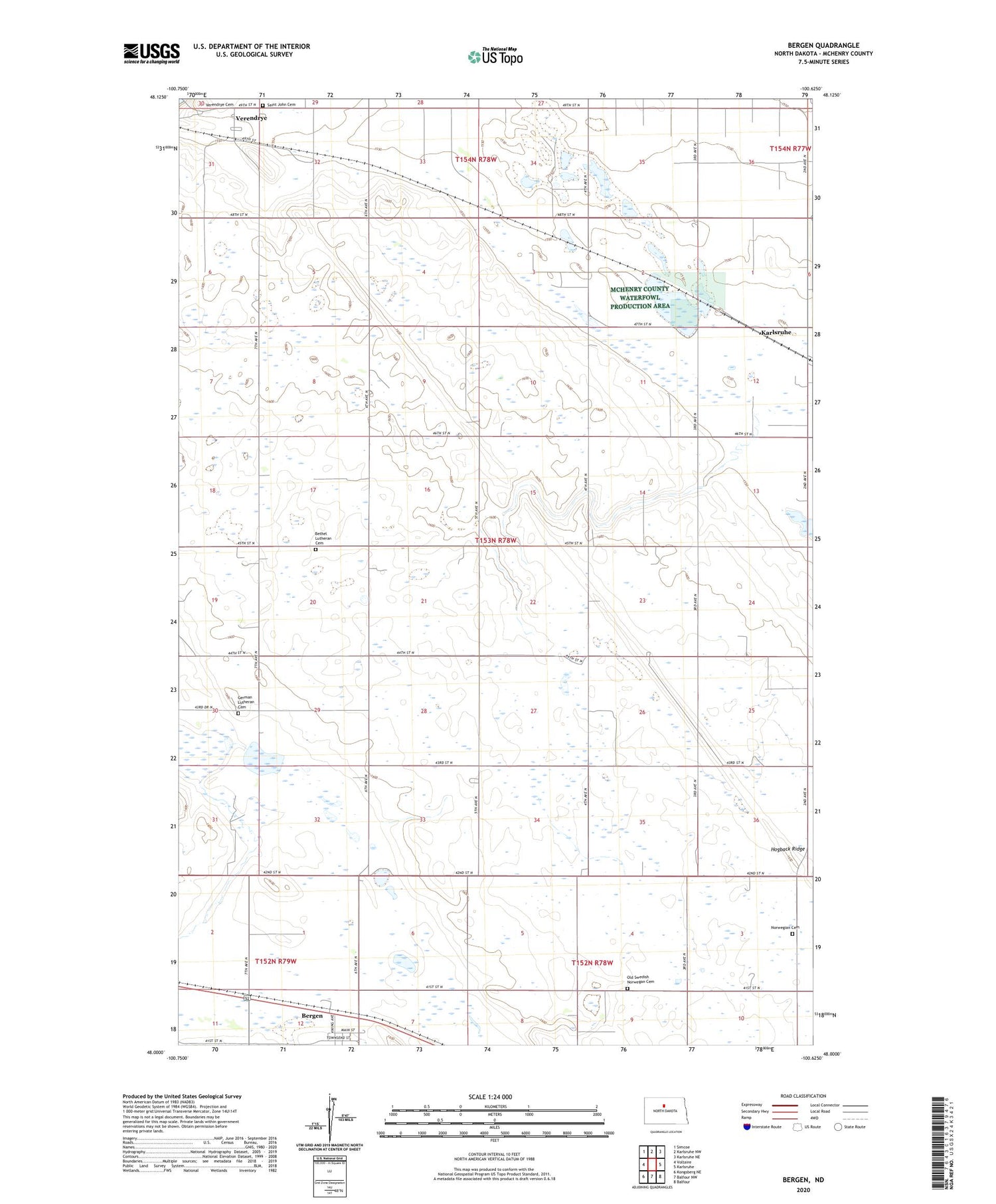
2020 topographic map quadrangle Bergen in the state of North Dakota. Scale: 1:24000. Based on the newly updated USGS 7.5' US Topo map series, this map is in the following counties: McHenry. The map contains contour data, water features, and other items you are used to seeing on USGS maps, but also has updated roads and other features. This is the next generation of topographic maps. Printed on high-quality waterproof paper with UV fade-resistant inks.
Quads adjacent to this one:
West: Voltaire
Northwest: Simcoe
North: Karlsruhe NW
Northeast: Karlsruhe NE
East: Karlsruhe
Southeast: Balfour
South: Balfour NW
Southwest: Kongsberg NE
Contains the following named places: Bergen, Bethel Church, Bethel Lutheran Cemetery, City of Bergen, David Thompson Memorial, German Lutheran Cemetery, Hogback Ridge, Norwegian Cemetery, Old Swedish Norwegan Cemetery, Saint John Cemetery, Saint Paul Church, School Number 3, Township of Lake Hester, Verendrye, Verendrye Cemetery