MyTopo
Bisbee North North Dakota US Topo Map
Couldn't load pickup availability
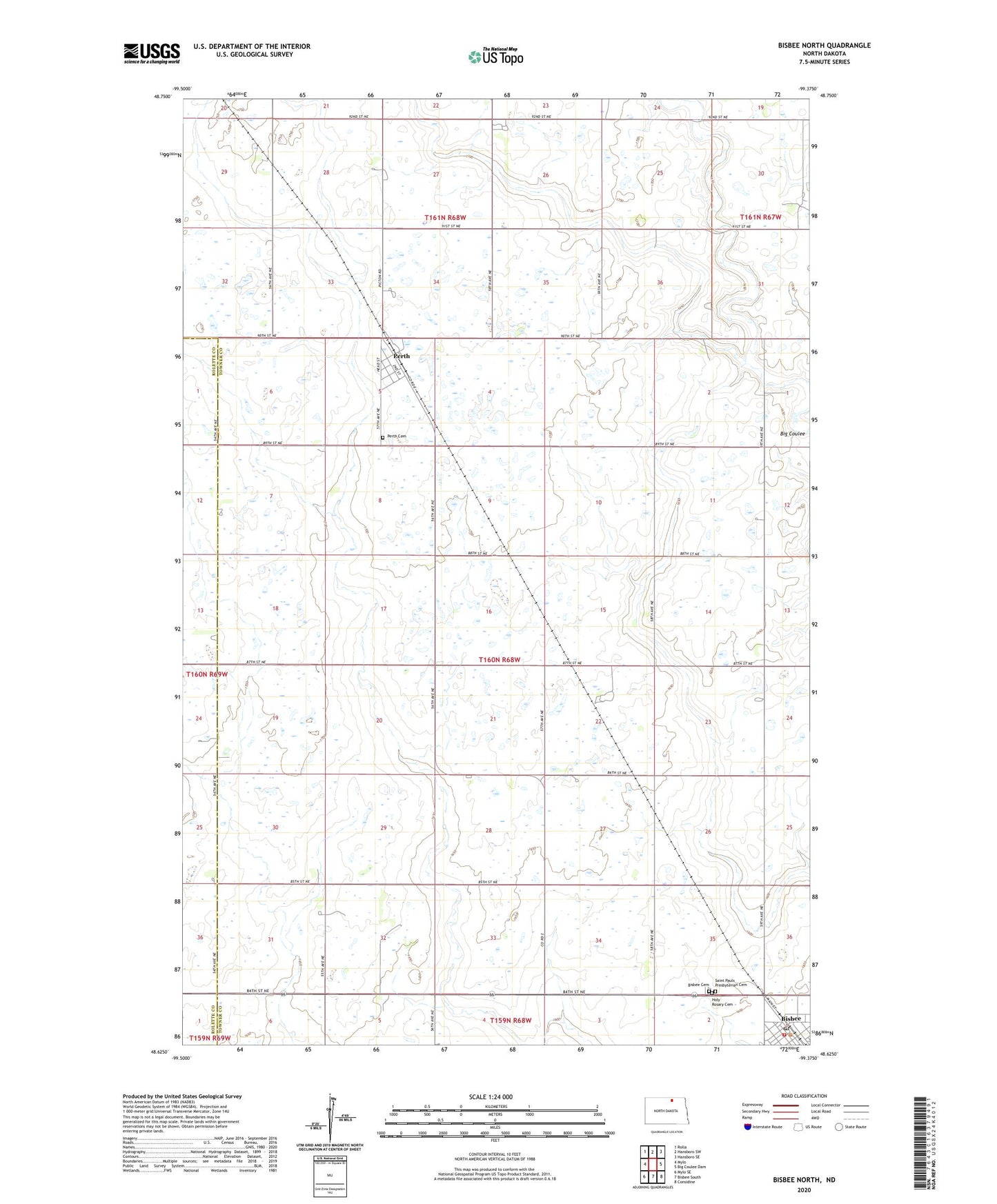
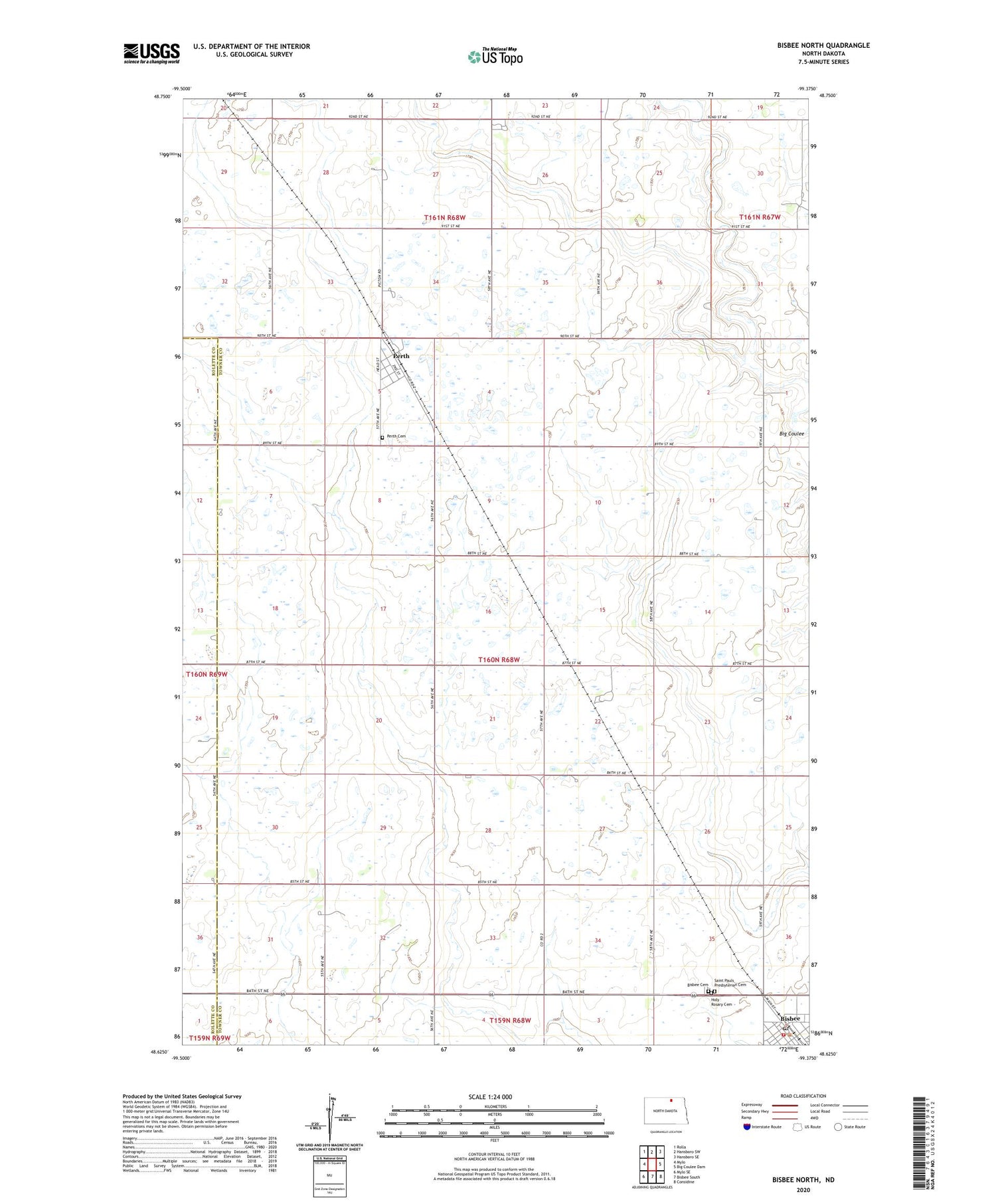
2020 topographic map quadrangle Bisbee North in the state of North Dakota. Scale: 1:24000. Based on the newly updated USGS 7.5' US Topo map series, this map is in the following counties: Towner, Rolette. The map contains contour data, water features, and other items you are used to seeing on USGS maps, but also has updated roads and other features. This is the next generation of topographic maps. Printed on high-quality waterproof paper with UV fade-resistant inks.
Quads adjacent to this one:
West: Mylo
Northwest: Rolla
North: Hansboro SW
Northeast: Hansboro SE
East: Big Coulee Dam
Southeast: Considine
South: Bisbee South
Southwest: Mylo SE
Contains the following named places: Bisbee, Bisbee Cemetery, Bisbee Fire Protection District, Bisbee Post Office, Bisbee Town Hall, City of Bisbee, City of Perth, Holy Rosary Cemetery, Lyster Field, Perth, Perth Cemetery, Saint Pauls Presbyterian Cemetery, Township of Grainfield