MyTopo
Cannon Ball SE North Dakota US Topo Map
Couldn't load pickup availability
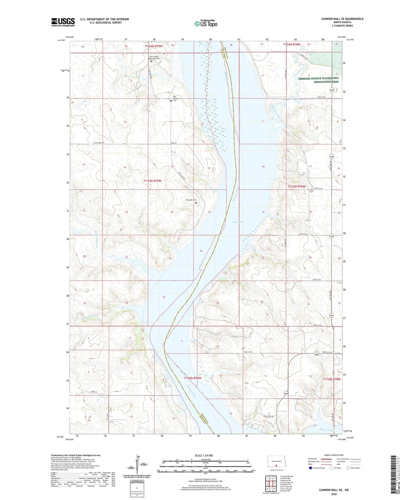
2020 topographic map quadrangle Cannon Ball SE in the state of North Dakota. Scale: 1:24000. Based on the newly updated USGS 7.5' US Topo map series, this map is in the following counties: Emmons, Sioux. The map contains contour data, water features, and other items you are used to seeing on USGS maps, but also has updated roads and other features. This is the next generation of topographic maps. Printed on high-quality waterproof paper with UV fade-resistant inks.
Quads adjacent to this one:
West: Cannon Ball SW
Northwest: Cannon Ball NW
North: Cannon Ball
Northeast: Hazelton NW
East: Hazelton SW
Southeast: Grassna NW
South: Fort Yates NE
Southwest: Fort Yates NW
Contains the following named places: Beaver Holes Creek, Big Lake Cemetery, Emmonsburg Post Office, Fool Bear Creek, Horsehead Creek, Old Catholic Cemetery, Saint James Church, Saint James Episcopal Cemetery