MyTopo
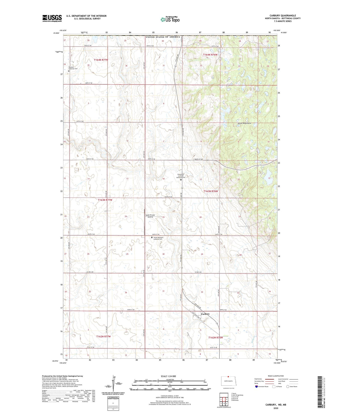
Carbury North Dakota US Topo Map
Couldn't load pickup availability
2020 topographic map quadrangle Carbury in the state of North Dakota. Scale: 1:24000. Based on the newly updated USGS 7.5' US Topo map series, this map is in the following counties: Bottineau. The map contains contour data, water features, and other items you are used to seeing on USGS maps, but also has updated roads and other features. This is the next generation of topographic maps. Printed on high-quality waterproof paper with UV fade-resistant inks.
Quads adjacent to this one:
West: Souris
East: Lake Klingenberg
Southeast: Bottineau
South: Souris SE
Southwest: Souris SW
Contains the following named places: Carbury, Eidsvold School Number 2, Emmanuel Church, Emmanuel Lutheran Brethren Cemetery, Mountain View School Number 1, Mountain View School Number 2, Mountain View School Number 4, Mystical Horizons Scenic Overlook, Sjule Private Airstrip, Strawberry Lake, Strawberry Lake Recreation Area, Swedish Church, Swedish Lutheran Cemetery, Township of Dalen, Turtle Mountain Church, Turtle Mountain Lutheran Cemetery, Twisted Oaks Equestrian Campground