MyTopo
Carrington East North Dakota US Topo Map
Couldn't load pickup availability
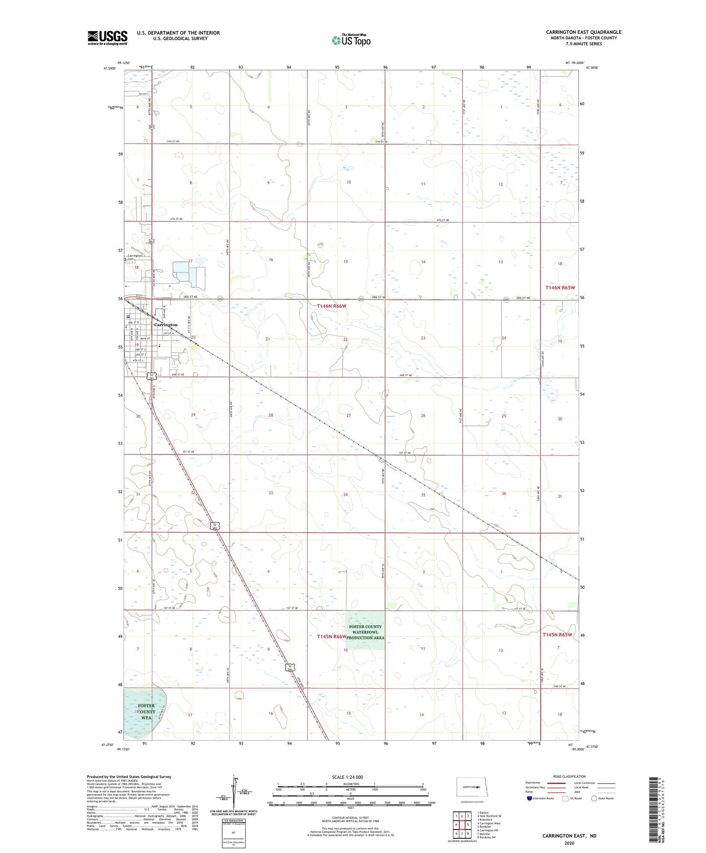
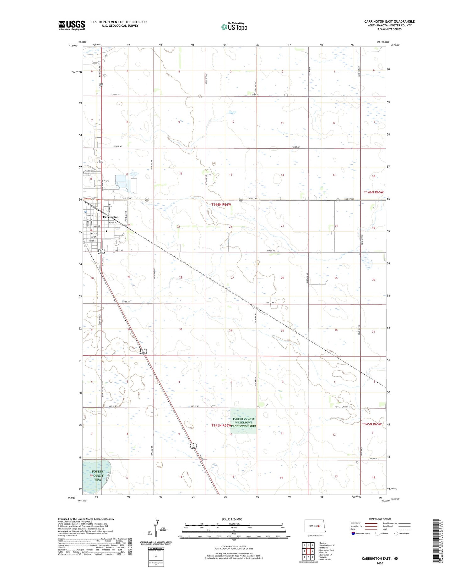
2020 topographic map quadrangle Carrington East in the state of North Dakota. Scale: 1:24000. Based on the newly updated USGS 7.5' US Topo map series, this map is in the following counties: Foster. The map contains contour data, water features, and other items you are used to seeing on USGS maps, but also has updated roads and other features. This is the next generation of topographic maps. Printed on high-quality waterproof paper with UV fade-resistant inks.
Quads adjacent to this one:
West: Carrington West
Northwest: Barlow
North: New Rockford SE
Northeast: Brantford
East: Bordulac
Southeast: Bordulac SW
South: Melville
Southwest: Carrington SW
Contains the following named places: Carrington Cemetery, Carrington City Library, Carrington Elementary School, Carrington High School, Carrington Water Works, Foster County Medical Center, Golden Acres Manor, KDAK-AM (Carrington), Putnam House Museum, School Number 1, School Number 4, Township of Carrington, ZIP Code: 58421